|
search place name
|
||
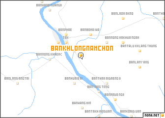
Ban Khlong Nam Chon (Tak, Thailand)Ban Khlong Nam Chon is a town in the Tak region of Thailand. An overview map of the region around Ban Khlong Nam Chon is displayed below.
regional and 3d topo map of Ban Khlong Nam Chon, Thailand ::
Ban Khlong Nam Chon airports ::
The nearest airport is PHS - Phitsanulok, located 118.7 km east of Ban Khlong Nam Chon.
Other airports nearby include LPT - Lampang (163.1 km north), PRH - Phrae (178.6 km north east), Nearby towns ::
Ban Lan Fang (2.6km north west) //
Tak (5.1km north west) //
Ban Bo Mai Wa (5.8km north) //
Ban Huai Sai (5.8km south) //
Ban Phae (6.6km north west) //
Ban Chalat (6.5km north west) //
Ban Pa Muang (6.5km north west) //
Ban Map Mako (6.5km north east) //
Ban Huai Nung (7.1km west) //
Ban Nong Khaem (2) (7.1km west) //
Ban Tha Mai Daeng (1) (7.7km south east) //
Ban Tong Teng (8.2km south east) //
[all distances 'as the bird flies' and approximate]  Places with similar names to Ban Khlong Nam Chon, Thailand :: Disclaimer :: Information on this page comes without warranty of any kind |
||
|
Where is Ban Khlong Nam Chon? Elevation and coordinates ::
Latitude (lat): 16°50'0"N Longitude (lon): 99°10'0"E
Elevation (approx.): 158m (map arrows pan, magnifying glasses zoom) |
||
|
Visiting Ban Khlong Nam Chon? Hotel/Accommodation ::
Book a hotel in Ban Khlong Nam Chon Travel Guide ::
Buy a travel guide for Thailand rental cars ::
car rental offers GPS waypoint ::
download a GPX waypoint (PoI) of Ban Khlong Nam Chon for your GPS receiver
|
||