|
search place name
|
||
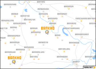
Ban Kho (Sisaket, Thailand)Ban Kho is a town in the Sisaket region of Thailand. An overview map of the region around Ban Kho is displayed below.
regional and 3d topo map of Ban Kho, Thailand ::
Ban Kho airports ::
The nearest airport is ZVK - Savannakhet, located 158.3 km north of Ban Kho.
Other airports nearby include PKZ - Pakse (166.6 km east), REP - Siem-reap Siem Reap (205.2 km south), SNO - Sakon Nakhon (219.0 km north), Nearby towns ::
Ban Sam (3.8km north east) //
Ban Wo (3.8km east) //
Ban Bon Yai (4.4km south west) //
Ban Non Noi (4.6km west) //
Ban Som Poi (5.5km north) //
Ban Puai (5.6km west) //
Ban Khu Sot (5.8km east) //
Ban Ko (7.1km north) //
Ban Ngong (7.3km north) //
Ban Tong Ton (8.5km north west) //
Ban Nong Lung (8.6km south west) //
Ban Nong Mi (8.9km north east) //
Ban Ya Plong (8.9km south east) //
Ban Som Poi (9.3km south west) //
Ban Kasem Suk (10.4km south west) //
[all distances 'as the bird flies' and approximate] 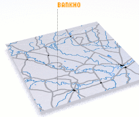 Places with similar names to Ban Kho, Thailand ::
// Ban Ai Khieo (TH)
// Ban Ai Khu (TH)
// Ban Ao Kho (TH)
// Ban Ao Khoei (TH)
// Ban I Kho (TH)
// Ban Kahae (TH)
// Ban Kha (TH)
// Ban Kha (TH)
// Ban Kha (TH)
// Ban Kha (TH)
Disclaimer :: Information on this page comes without warranty of any kind |
||
|
Where is Ban Kho? Elevation and coordinates ::
Latitude (lat): 15°13'10"N Longitude (lon): 104°14'0"E
Elevation (approx.): 136m (map arrows pan, magnifying glasses zoom) |
||
|
Visiting Ban Kho? Hotel/Accommodation ::
Book a hotel in Ban Kho Travel Guide ::
Buy a travel guide for Thailand rental cars ::
car rental offers GPS waypoint ::
download a GPX waypoint (PoI) of Ban Kho for your GPS receiver
|
||