|
search place name
|
||
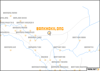
Ban Khok I Long (Prachin Buri, Thailand)Ban Khok I Long is a town in the Prachin Buri region of Thailand. An overview map of the region around Ban Khok I Long is displayed below.
regional and 3d topo map of Ban Khok I Long, Thailand ::
Ban Khok I Long airports ::
The nearest airport is NAK - Nakhon Ratchasima Khorat, located 114.5 km north of Ban Khok I Long.
Other airports nearby include BKK - Bangkok Intl (159.6 km west), UTP - Rayong U Taphao Intl (178.5 km south west), REP - Siem-reap Siem Reap (194.8 km east), Nearby towns ::
Ban Lao Oi (5.4km west) //
Ban Wang Chan (5.7km west) //
Ban Tha Yaek (6.6km south east) //
Ban Dan Khok Sung (7.4km west) //
Ban Sala Lamduan (7.4km west) //
Ban Khok Nok Khunthong (7.7km south west) //
Ban Wang Ti Ok (7.7km south west) //
[all distances 'as the bird flies' and approximate] 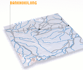 Places with similar names to Ban Khok I Long, Thailand ::
// Ban Khao Khlang (TH)
// Ban Khao Khlung (TH)
// Ban Khok Khlang (TH)
// Ban Khok Khlong (TH)
// Ban Khok Klang (TH)
// Ban Khok Klang (TH)
// Ban Khok Klang (TH)
// Ban Khok Klang (TH)
// Ban Khok Klang (TH)
// Ban Khok Klang (TH)
Disclaimer :: Information on this page comes without warranty of any kind |
||
|
Where is Ban Khok I Long? Elevation and coordinates ::
Latitude (lat): 13°54'0"N Longitude (lon): 102°5'0"E
Elevation (approx.): 31m (map arrows pan, magnifying glasses zoom) |
||
|
Visiting Ban Khok I Long? Hotel/Accommodation ::
Book a hotel in Ban Khok I Long Travel Guide ::
Buy a travel guide for Thailand rental cars ::
car rental offers GPS waypoint ::
download a GPX waypoint (PoI) of Ban Khok I Long for your GPS receiver
|
||