|
search place name
|
||
Ban Khok Lam (Khon Kaen, Thailand)Ban Khok Lam is a town in the Khon Kaen region of Thailand. An overview map of the region around Ban Khok Lam is displayed below.
regional and 3d topo map of Ban Khok Lam, Thailand ::

Ban Khok Lam airports ::
The nearest airport is UTH - Udon Thani, located 63.9 km north west of Ban Khok Lam.
Other airports nearby include SNO - Sakon Nakhon (119.4 km east), VTE - Vientiane Wattay Intl (134.5 km north), LOE - Loei (154.8 km north west), ZVK - Savannakhet (185.5 km east), Nearby towns ::
Ban Hua Na Kham (3.7km south) //
Ban Thom Pa Kha (5.1km north west) //
Ban Lao Mak Chan (5.6km north) //
Ban Sam Wang (6.6km south east) //
Ban Kut Khon Kaen (8.0km north east) //
Ban Non Sung (8.0km north east) //
Ban Na Than (9.1km north east) //
Ban Khok Yai (9.1km south west) //
[all distances 'as the bird flies' and approximate] 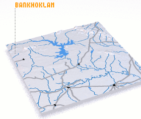 Places with similar names to Ban Khok Lam, Thailand ::
// Ban Khaek Lom (TH)
// Ban Khao Klam (TH)
// Ban Khao Klom (TH)
// Ban Khok Lam (TH)
// Ban Khok Lam (TH)
// Ban Khok Lam (TH)
// Ban Khok Lam (TH)
// Ban Khok Lam (TH)
Disclaimer :: Information on this page comes without warranty of any kind |
||
|
Where is Ban Khok Lam? Elevation and coordinates ::
Latitude (lat): 16°52'0"N Longitude (lon): 103°3'0"E
Elevation (approx.): 234m (map arrows pan, magnifying glasses zoom) |
||
|
Visiting Ban Khok Lam? Hotel/Accommodation ::
Book a hotel in Ban Khok Lam Travel Guide ::
Buy a travel guide for Thailand rental cars ::
car rental offers GPS waypoint ::
download a GPX waypoint (PoI) of Ban Khok Lam for your GPS receiver
|
||