|
search place name
|
||
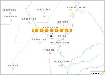
Ban Khok Makham Pom (Lop Buri, Thailand)Ban Khok Makham Pom is a town in the Lop Buri region of Thailand. An overview map of the region around Ban Khok Makham Pom is displayed below.
regional and 3d topo map of Ban Khok Makham Pom, Thailand ::
Ban Khok Makham Pom airports ::
The nearest airport is NAK - Nakhon Ratchasima Khorat, located 113.8 km east of Ban Khok Makham Pom.
Other airports nearby include BKK - Bangkok Intl (132.0 km south), PHS - Phitsanulok (209.4 km north), Nearby towns ::
Ban Thanon Khat (2.5km north) //
Ban Puk Ri (3.7km east) //
Ban Kaeng Phak Kut (3.9km south east) //
Ban Makok Wan (1) (4.8km north east) //
Ban Fai Huai Hin (4.9km west) //
Tha Luang (5.6km south) //
Ban Khok Salung (5.7km south) //
Ban Huai Na (5.8km north east) //
Ban Pang Phao Than (6.6km west) //
Ban Dong Nok (7.9km north) //
Ban Fao Rai (8.2km north) //
Ban Sap Yang (9.4km north) //
Ban Huai Hin (9.8km north west) //
Ban Huai Khi Nu (9.8km north west) //
Ban Tha Tako (10.9km north east) //
[all distances 'as the bird flies' and approximate] 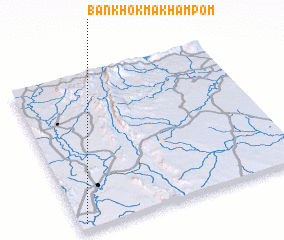 Places with similar names to Ban Khok Makham Pom, Thailand :: Disclaimer :: Information on this page comes without warranty of any kind |
||
|
Where is Ban Khok Makham Pom? Elevation and coordinates ::
Latitude (lat): 15°2'0"N Longitude (lon): 101°1'31"E
Elevation (approx.): 39m (map arrows pan, magnifying glasses zoom) |
||
|
Visiting Ban Khok Makham Pom? Hotel/Accommodation ::
Book a hotel in Ban Khok Makham Pom Travel Guide ::
Buy a travel guide for Thailand rental cars ::
car rental offers GPS waypoint ::
download a GPX waypoint (PoI) of Ban Khok Makham Pom for your GPS receiver
|
||