|
search place name
|
||
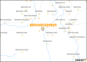
Ban Khok Sombun (Buriram, Thailand)Ban Khok Sombun is a town in the Buriram region of Thailand. An overview map of the region around Ban Khok Sombun is displayed below.
regional and 3d topo map of Ban Khok Sombun, Thailand ::
Ban Khok Sombun airports ::
The nearest airport is NAK - Nakhon Ratchasima Khorat, located 94.6 km north west of Ban Khok Sombun.
Other airports nearby include REP - Siem-reap Siem Reap (157.4 km south east), UTP - Rayong U Taphao Intl (266.8 km south west), Nearby towns ::
Ban Nong To (1.9km north) //
Ban Hu Thamnop (1.8km west) //
Ban Takong (2.6km south east) //
Amphoe Lahan Sai (2.6km south east) //
Ban Khok Mai (2.6km south east) //
Ban Khok Wan (2.6km south east) //
Ban Nong Ki (2.6km north east) //
Ban Nong Krat (4.0km south east) //
Ban Nong Krat (5.8km north) //
Ban Som Poi (5.8km south) //
Ban Kong Phra Sai (6.6km north west) //
Ban Kut Ta Sa (7.6km north) //
Prakham (7.6km north) //
Ban Thanon Hak (7.7km north west) //
Ban Nong Mi (8.2km north east) //
Ban Takong (8.1km north east) //
Ban Nong Nam Khun (1) (9.1km north west) //
[all distances 'as the bird flies' and approximate] 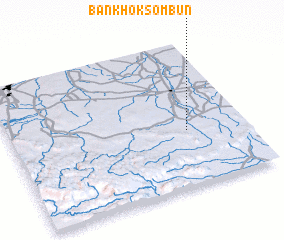 Places with similar names to Ban Khok Sombun, Thailand ::
// Ban Khok Sombun (TH)
// Ban Khok Sombun (TH)
Disclaimer :: Information on this page comes without warranty of any kind |
||
|
Where is Ban Khok Sombun? Elevation and coordinates ::
Latitude (lat): 14°23'0"N Longitude (lon): 102°45'0"E
Elevation (approx.): 211m (map arrows pan, magnifying glasses zoom) |
||
|
Visiting Ban Khok Sombun? Hotel/Accommodation ::
Book a hotel in Ban Khok Sombun Travel Guide ::
Buy a travel guide for Thailand rental cars ::
car rental offers GPS waypoint ::
download a GPX waypoint (PoI) of Ban Khok Sombun for your GPS receiver
|
||