|
search place name
|
||
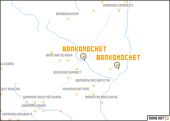
Ban Komo Chet (Yala, Thailand)Ban Komo Chet is a town in the Yala region of Thailand. An overview map of the region around Ban Komo Chet is displayed below.
regional and 3d topo map of Ban Komo Chet, Thailand ::
Ban Komo Chet airports ::
The nearest airport is AOR - Alor Setar Sultan Abdul Halim, located 88.0 km north west of Ban Komo Chet.
Other airports nearby include NAW - Narathiwat (105.4 km north east), PAN - Pattani (107.3 km north), PEN - Penang Intl (107.8 km south west), KBR - Kota Bahru Sultan Ismail Petra (137.6 km east), Nearby towns ::
Ban Bo Nam Ron (2.6km north west) //
Ban Cha Ro Pa Tai (2.6km south west) //
Kampong Cheraekbute (3.7km west) //
Ban Komo Sip Paet (5.2km south west) //
Ban Cha Ro Cha Wa (5.5km west) //
Ban Saphan Chang Tai (5.9km south) //
Ban Ban Na La (5.8km east) //
Ban Bo Nam Ron (7.6km west) //
Betong (7.6km south) //
Kampong Betong (7.6km south) //
Ban Komo Chet (7.6km east) //
Ban Ra Mong (7.6km south) //
[all distances 'as the bird flies' and approximate] 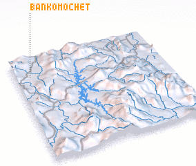 Places with similar names to Ban Komo Chet, Thailand ::
// Ban Komo Chet (TH)
Disclaimer :: Information on this page comes without warranty of any kind |
||
|
Where is Ban Komo Chet? Elevation and coordinates ::
Latitude (lat): 5°49'0"N Longitude (lon): 101°6'0"E
Elevation (approx.): 286m (map arrows pan, magnifying glasses zoom) |
||
|
Visiting Ban Komo Chet? Hotel/Accommodation ::
Book a hotel in Ban Komo Chet Travel Guide ::
Buy a travel guide for Thailand rental cars ::
car rental offers GPS waypoint ::
download a GPX waypoint (PoI) of Ban Komo Chet for your GPS receiver
|
||