|
search place name
|
||
Ban Kong Khan (Nong Khai, Thailand)Ban Kong Khan is a town in the Nong Khai region of Thailand. An overview map of the region around Ban Kong Khan is displayed below.
regional and 3d topo map of Ban Kong Khan, Thailand ::

Ban Kong Khan airports ::
The nearest airport is VTE - Vientiane Wattay Intl, located 62.2 km west of Ban Kong Khan.
Other airports nearby include UTH - Udon Thani (65.1 km south west), SNO - Sakon Nakhon (128.2 km south east), LOE - Loei (157.5 km west), ZVK - Savannakhet (225.6 km south east), Nearby towns ::
Ban Dong Saphang (3.8km south east) //
Ban Maet (5.2km west) //
Ban Na Nang (5.8km north) //
Ban Paen (6.4km north west) //
Ban Sang Khom (6.5km south west) //
Ban Na Mang (6.6km south east) //
Ban Wan (6.9km north east) //
Ban Hat Chang (6.8km north west) //
King Amphoe Sang Khom (6.8km south west) //
Ban Nong Aek (7.8km east) //
Ban Thon Na Lap (8.3km east) //
Ban Dong Bang Nua (8.4km north west) //
Ban Don Bak (9.5km south west) //
Ban Nong Lat (10.5km south east) //
Ban Phu (11.1km north east) //
[all distances 'as the bird flies' and approximate] 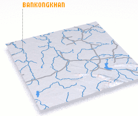 Places with similar names to Ban Kong Khan, Thailand ::
// Ban Kèngkhèn (LA)
// Ban Kèngkhèn (LA)
// Ban Kèngkhôn (LA)
// Ban Kèngkhoun (LA)
// Ban Kongkhoun (LA)
Disclaimer :: Information on this page comes without warranty of any kind |
||
|
Where is Ban Kong Khan? Elevation and coordinates ::
Latitude (lat): 17°52'11"N Longitude (lon): 103°8'14"E
Elevation (approx.): 167m (map arrows pan, magnifying glasses zoom) |
||
|
Visiting Ban Kong Khan? Hotel/Accommodation ::
Book a hotel in Ban Kong Khan Travel Guide ::
Buy a travel guide for Thailand rental cars ::
car rental offers GPS waypoint ::
download a GPX waypoint (PoI) of Ban Kong Khan for your GPS receiver
|
||