|
search place name
|
||
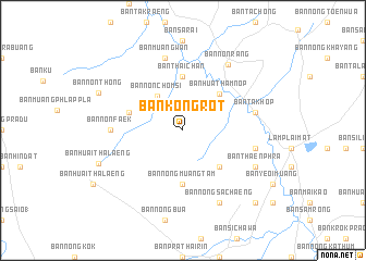
Ban Kong Rot (Nakhon Ratchasima, Thailand)Ban Kong Rot is a town in the Nakhon Ratchasima region of Thailand. An overview map of the region around Ban Kong Rot is displayed below.
regional and 3d topo map of Ban Kong Rot, Thailand ::
Ban Kong Rot airports ::
The nearest airport is NAK - Nakhon Ratchasima Khorat, located 71.3 km west of Ban Kong Rot.
Other airports nearby include REP - Siem-reap Siem Reap (214.0 km south east), Nearby towns ::
Ban Non Chom Si (4.3km north west) //
Ban Nong Kating (5.2km south east) //
Ban Hua Thamnop (5.2km north east) //
Ban Thai Chan (5.6km north) //
Ban Nong Muang Tam (5.6km south) //
Ban Nong Muang Yai (5.7km west) //
Ban Non Faek (7.2km west) //
Ban Muang Wan (7.6km north) //
Ban Khok Sanuan (7.4km east) //
Ban Takhop (7.4km east) //
Ban Non Rang (8.1km north east) //
Ban Nong Sachaeng (8.2km south east) //
Ban Thaen Phra (8.1km south east) //
Ban Huai Thalaeng (9.0km west) //
Ban Non Thong (9.2km north west) //
Ban Nong Ian (10.3km south east) //
[all distances 'as the bird flies' and approximate]  Places with similar names to Ban Kong Rot, Thailand :: Disclaimer :: Information on this page comes without warranty of any kind |
||
|
Where is Ban Kong Rot? Elevation and coordinates ::
Latitude (lat): 15°2'0"N Longitude (lon): 102°44'0"E
Elevation (approx.): 171m (map arrows pan, magnifying glasses zoom) |
||
|
Visiting Ban Kong Rot? Hotel/Accommodation ::
Book a hotel in Ban Kong Rot Travel Guide ::
Buy a travel guide for Thailand rental cars ::
car rental offers GPS waypoint ::
download a GPX waypoint (PoI) of Ban Kong Rot for your GPS receiver
|
||