|
search place name
|
||
Ban Ko Yang (Surat Thani, Thailand)Ban Ko Yang is a town in the Surat Thani region of Thailand. An overview map of the region around Ban Ko Yang is displayed below.
regional and 3d topo map of Ban Ko Yang, Thailand ::

Ban Ko Yang airports ::
The nearest airport is NST - Nakhon Si Thammarat Cha Ian, located 159.7 km south east of Ban Ko Yang.
Other airports nearby include HKT - Phuket Intl (197.2 km south west), Nearby towns ::
Ban Duat Pit (1.9km south) //
Ban Khao Noi (2.6km south west) //
Ban Nong Chut (2.6km south west) //
Ban Khan Thuli (3.7km south) //
Ban Khao Chawala (3.7km west) //
Ban Khao Te (5.8km west) //
Ban Don Thup (5.9km south) //
Ban Nong Met (6.7km south west) //
Ban Nai Phru (7.6km south) //
Ban Khao Din (8.3km south west) //
[all distances 'as the bird flies' and approximate] 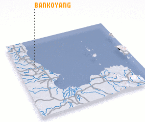 Places with similar names to Ban Ko Yang, Thailand ::
// Ban Ko Yai Nak (TH)
// Ban Ko Yang (TH)
// Bangayanga (CF)
// Bongoyankoi (CD)
// Ban Nakayong (LA)
// Baunggyaung (MM)
// Baunggyaung (MM)
Disclaimer :: Information on this page comes without warranty of any kind |
||
|
Where is Ban Ko Yang? Elevation and coordinates ::
Latitude (lat): 9°41'0"N Longitude (lon): 99°10'0"E
Elevation (approx.): -32768m (map arrows pan, magnifying glasses zoom) |
||
|
Visiting Ban Ko Yang? Hotel/Accommodation ::
Book a hotel in Ban Ko Yang Travel Guide ::
Buy a travel guide for Thailand rental cars ::
car rental offers GPS waypoint ::
download a GPX waypoint (PoI) of Ban Ko Yang for your GPS receiver
|
||