|
search place name
|
||
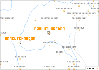
Ban Kut Khae Don (Ubon Ratchathani, Thailand)Ban Kut Khae Don is a town in the Ubon Ratchathani region of Thailand. An overview map of the region around Ban Kut Khae Don is displayed below.
regional and 3d topo map of Ban Kut Khae Don, Thailand ::
Ban Kut Khae Don airports ::
The nearest airport is ZVK - Savannakhet, located 44.9 km north east of Ban Kut Khae Don.
Other airports nearby include SNO - Sakon Nakhon (104.6 km north), PKZ - Pakse (193.9 km south east), UTH - Udon Thani (212.6 km north west), VTE - Vientiane Wattay Intl (273.0 km north west), Nearby towns ::
Ban Chiang Mi (2.6km south east) //
Ban Kham Phok (3.7km south) //
Ban Muang Khai (3.7km south) //
Ban Hong Saeng (4.1km south west) //
Ban Nong Nok Khian (5.6km north) //
Ban Pa Chat (7.4km west) //
Ban Khok Hin Kong (7.7km north west) //
Ban Wai (8.2km south east) //
Ban Kut Mahong (9.0km south east) //
[all distances 'as the bird flies' and approximate] 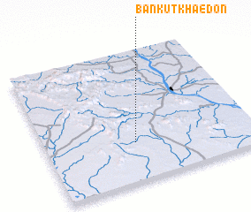 Places with similar names to Ban Kut Khae Don, Thailand ::
// Ban Kut Khae Don (TH)
Disclaimer :: Information on this page comes without warranty of any kind |
||
|
Where is Ban Kut Khae Don? Elevation and coordinates ::
Latitude (lat): 16°18'0"N Longitude (lon): 104°26'0"E
Elevation (approx.): 168m (map arrows pan, magnifying glasses zoom) |
||
|
Visiting Ban Kut Khae Don? Hotel/Accommodation ::
Book a hotel in Ban Kut Khae Don Travel Guide ::
Buy a travel guide for Thailand rental cars ::
car rental offers GPS waypoint ::
download a GPX waypoint (PoI) of Ban Kut Khae Don for your GPS receiver
|
||