|
search place name
|
||
Ban Kut Kwang (Thailand)Ban Kut Kwang is a town in Thailand. An overview map of the region around Ban Kut Kwang is displayed below.
regional and 3d topo map of Ban Kut Kwang, Thailand ::

Ban Kut Kwang airports ::
The nearest airport is UTH - Udon Thani, located 114.8 km north of Ban Kut Kwang.
Other airports nearby include LOE - Loei (162.9 km north west), NAK - Nakhon Ratchasima Khorat (172.4 km south west), SNO - Sakon Nakhon (173.3 km north east), VTE - Vientiane Wattay Intl (182.4 km north), Nearby towns ::
Changwat Khon Kaen (0.0km north) //
Ban Nong Pho (2.6km south east) //
Ban Thum (3.6km west) //
Ban Lao Na Di (5.1km north west) //
Ban Nong Waeng Hi (5.1km south west) //
Ban Tha Phra (5.3km east) //
Ban Kut Kwang (5.6km east) //
Ban Khok Sung (5.8km north) //
Ban Non Sa-at (6.6km north east) //
Ban Nong Bua Di Mi (6.5km south east) //
Ban Na Lom (7.1km west) //
Ban Ton (7.6km south) //
Ban Kho (9.0km north west) //
Ban Nong Waeng (9.0km south east) //
Ban Khum Din (9.1km south west) //
Ban Kham Pom (10.3km south west) //
[all distances 'as the bird flies' and approximate] 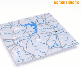 Places with similar names to Ban Kut Kwang, Thailand ::
// Ban Kut Kwang (TH)
Disclaimer :: Information on this page comes without warranty of any kind |
||
|
Where is Ban Kut Kwang? Elevation and coordinates ::
Latitude (lat): 16°21'0"N Longitude (lon): 102°45'0"E
Elevation (approx.): 183m (map arrows pan, magnifying glasses zoom) |
||
|
Visiting Ban Kut Kwang? Hotel/Accommodation ::
Book a hotel in Ban Kut Kwang Travel Guide ::
Buy a travel guide for Thailand rental cars ::
car rental offers GPS waypoint ::
download a GPX waypoint (PoI) of Ban Kut Kwang for your GPS receiver
|
||