|
search place name
|
||
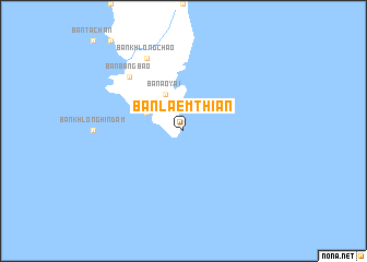
Ban Laem Thian (Trat, Thailand)Ban Laem Thian is a town in the Trat region of Thailand. An overview map of the region around Ban Laem Thian is displayed below.
regional and 3d topo map of Ban Laem Thian, Thailand ::
Ban Laem Thian airports ::
The nearest airport is UTP - Rayong U Taphao Intl, located 212.9 km north west of Ban Laem Thian.
Other airports nearby include REP - Siem-reap Siem Reap (242.9 km north east), Nearby towns ::
Ban Khlong Phrao (4.1km north west) //
Ban Ao Yai (4.1km north west) //
Ban Bang Bao (7.8km north west) //
Ban Khlong Chao (8.3km north west) //
[all distances 'as the bird flies' and approximate]  Places with similar names to Ban Laem Thian, Thailand ::
Disclaimer :: Information on this page comes without warranty of any kind |
||
|
Where is Ban Laem Thian? Elevation and coordinates ::
Latitude (lat): 11°34'0"N Longitude (lon): 102°36'0"E
Elevation (approx.): -32768m (map arrows pan, magnifying glasses zoom) |
||
|
Visiting Ban Laem Thian? Hotel/Accommodation ::
Book a hotel in Ban Laem Thian Travel Guide ::
Buy a travel guide for Thailand rental cars ::
car rental offers GPS waypoint ::
download a GPX waypoint (PoI) of Ban Laem Thian for your GPS receiver
|
||