|
search place name
|
||
Ban Lam Ru (2) (Phangnga, Thailand)Ban Lam Ru (2) is a town in the Phangnga region of Thailand. An overview map of the region around Ban Lam Ru (2) is displayed below.
regional and 3d topo map of Ban Lam Ru (2), Thailand ::

Ban Lam Ru (2) airports ::
The nearest airport is HKT - Phuket Intl, located 60.7 km south of Ban Lam Ru (2).
Other airports nearby include NST - Nakhon Si Thammarat Cha Ian (168.7 km east), TST - Trang (181.5 km south east), HDY - Songkhla Hat Yai Intl (287.7 km south east), Nearby towns ::
Ban Talat Chochae (2.6km north east) //
Ban Pak That (4.1km north west) //
Ban Nai Not (4.1km north west) //
Kapong (4.1km north east) //
Ban Bok Phra (5.9km north) //
Ban Mo (6.7km north west) //
Ban Thap Riang (6.6km south west) //
Ban Khlong Raeng Hin (7.4km north) //
Ban Thap Riang (1) (7.4km south) //
Ban Bang Phang (7.6km north) //
Ban Bang Kaeo (8.3km north west) //
Ban Khang Khao (9.2km north west) //
Ban Ko Ping (9.2km south east) //
Ban Khlong Yang (10.4km north west) //
Ban Muang Haeng (10.4km south west) //
[all distances 'as the bird flies' and approximate] 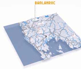 Places with similar names to Ban Lam Ru (2), Thailand :: Disclaimer :: Information on this page comes without warranty of any kind |
||
|
Where is Ban Lam Ru (2)? Elevation and coordinates ::
Latitude (lat): 8°39'0"N Longitude (lon): 98°26'0"E
Elevation (approx.): 71m (map arrows pan, magnifying glasses zoom) |
||
|
Visiting Ban Lam Ru (2)? Hotel/Accommodation ::
Book a hotel in Ban Lam Ru (2) Travel Guide ::
Buy a travel guide for Thailand rental cars ::
car rental offers GPS waypoint ::
download a GPX waypoint (PoI) of Ban Lam Ru (2) for your GPS receiver
|
||