|
search place name
|
||
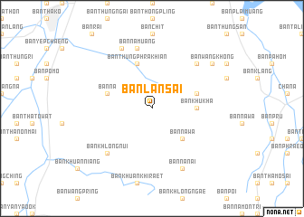
Ban Lan Sai (Songkhla, Thailand)Ban Lan Sai is a town in the Songkhla region of Thailand. An overview map of the region around Ban Lan Sai is displayed below.
regional and 3d topo map of Ban Lan Sai, Thailand ::
Ban Lan Sai airports ::
The nearest airport is HDY - Songkhla Hat Yai Intl, located 21.4 km west of Ban Lan Sai.
Other airports nearby include PAN - Pattani (64.3 km east), AOR - Alor Setar Sultan Abdul Halim (81.2 km south), LGK - Pulau Langkawi Intl (113.6 km south west), TST - Trang (126.2 km north west), Nearby towns ::
Ban Na Wa (5.2km south east) //
Ban Chong Khao (5.2km south east) //
Ban Khuan Khi Raet (5.2km south east) //
Ban Khu Kha (5.5km east) //
Ban Thung Phra Khian (5.9km north) //
Ban Khuan Mai Phai (5.8km east) //
Ban Na (5.8km west) //
Ban Na Muang (7.6km north) //
Ban Tha Chuak (7.8km north east) //
Ban Khlong Nui (7.8km south west) //
Ban Cha Phlu (8.3km north west) //
Ban Na Nai (8.3km south east) //
Ban Khu Nai (8.3km south east) //
Ban Wang Khong (9.2km north east) //
[all distances 'as the bird flies' and approximate] 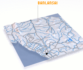 Places with similar names to Ban Lan Sai, Thailand ::
// Ban Lan So (TH)
// Banlunas (ID)
Disclaimer :: Information on this page comes without warranty of any kind |
||
|
Where is Ban Lan Sai? Elevation and coordinates ::
Latitude (lat): 6°54'0"N Longitude (lon): 100°35'0"E
Elevation (approx.): 103m (map arrows pan, magnifying glasses zoom) |
||
|
Visiting Ban Lan Sai? Hotel/Accommodation ::
Book a hotel in Ban Lan Sai Travel Guide ::
Buy a travel guide for Thailand rental cars ::
car rental offers GPS waypoint ::
download a GPX waypoint (PoI) of Ban Lan Sai for your GPS receiver
|
||