|
search place name
|
||
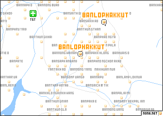
Ban Lo Phak Kut (Thailand)Ban Lo Phak Kut is a town in Thailand. An overview map of the region around Ban Lo Phak Kut is displayed below.
regional and 3d topo map of Ban Lo Phak Kut, Thailand ::
Ban Lo Phak Kut airports ::
The nearest airport is TST - Trang, located 15.0 km north west of Ban Lo Phak Kut.
Other airports nearby include HDY - Songkhla Hat Yai Intl (91.9 km south east), NST - Nakhon Si Thammarat Cha Ian (119.6 km north), LGK - Pulau Langkawi Intl (120.2 km south), AOR - Alor Setar Sultan Abdul Halim (155.2 km south east), Nearby towns ::
Ban Sai Khan (0.0km north) //
Ban Lam Thu (0.0km north) //
Ban Phru Nai Chang (0.0km north) //
Ban Hua Thanon (1.8km east) //
Ban Nak Boek Nua (1.9km north) //
Ban Ko Song Muang (1.9km north) //
Ban Saphan Takhian (1.9km south) //
Ban Khuan To Pu (1.8km west) //
Ban Ko Klang (1.8km west) //
Ban Phlu Kham Wan (2.6km north east) //
Ban Nak Baek (2.6km north east) //
Ban Ko Pho (3) (2.6km north west) //
Ban Pak Khlong (3.7km east) //
Ban Nong Sam Hong (3.7km north) //
Ban Khlong Sai Khao (1) (3.7km north) //
Ban Nong Yang (3.7km south) //
Ban Nong Ai Nok (3.7km west) //
Ban Nong Wai Nam (3.7km west) //
Ban Mut Si Da (4.1km north east) //
Ban Map Tao (4.1km north east) //
Ban Nong Samet (4) (4.1km north west) //
Ban Nong Kok (2) (4.1km north west) //
Ban Saphan Dan (1) (4.1km south west) //
Ban Nong Pet (5.2km north east) //
Ban Na Yi Khom (5.2km south east) //
Ban Nong Khon (5.2km south east) //
Ban Khok Mamuang (5.2km north west) //
Ban Yan Ta Khao (5.2km south west) //
Ban Sam Yaek Phru Tu Puk (5.6km south) //
[all distances 'as the bird flies' and approximate]  Places with similar names to Ban Lo Phak Kut, Thailand ::
// Ban Lo Phak Kut (TH)
Disclaimer :: Information on this page comes without warranty of any kind |
||
|
Where is Ban Lo Phak Kut? Elevation and coordinates ::
Latitude (lat): 7°25'0"N Longitude (lon): 99°43'0"E
Elevation (approx.): 26m (map arrows pan, magnifying glasses zoom) |
||
|
Visiting Ban Lo Phak Kut? Hotel/Accommodation ::
Book a hotel in Ban Lo Phak Kut Travel Guide ::
Buy a travel guide for Thailand rental cars ::
car rental offers GPS waypoint ::
download a GPX waypoint (PoI) of Ban Lo Phak Kut for your GPS receiver
|
||