|
search place name
|
||
Ban Luang (Chiang Mai, Thailand)Ban Luang is a town in the Chiang Mai region of Thailand. An overview map of the region around Ban Luang is displayed below.
regional and 3d topo map of Ban Luang, Thailand ::

Ban Luang airports ::
The nearest airport is LPT - Lampang, located 96.1 km south of Ban Luang.
Other airports nearby include PRH - Phrae (147.7 km south east), MOG - Mong Hsat (158.9 km north), THL - Tachilek Tachileik (173.9 km north east), Nearby towns ::
Ban Pa Ha (1) (1.9km north) //
Ban Mae Bon (2.5km north east) //
Ban Na Meng (1) (3.7km north) //
Ban Thung Daeng (1) (3.7km north) //
Ban Pa Taeng (3.7km north) //
Ban Mae Sai Na Lao (6.6km north east) //
[all distances 'as the bird flies' and approximate] 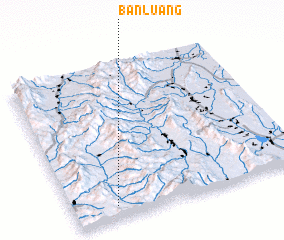 Places with similar names to Ban Luang, Thailand ::
// Ban Alang (TH)
// Ban Ao Ling (TH)
// Ban Laeng (TH)
// Ban Laeng (TH)
// Ban Lai Ngao (TH)
// Ban Lang (TH)
// Ban Lan Nok (TH)
// Ban Loeng (TH)
// Ban Long (TH)
// Ban Long O (TH)
Disclaimer :: Information on this page comes without warranty of any kind |
||
|
Where is Ban Luang? Elevation and coordinates ::
Latitude (lat): 19°5'0"N Longitude (lon): 99°11'0"E
Elevation (approx.): 455m (map arrows pan, magnifying glasses zoom) |
||
|
Visiting Ban Luang? Hotel/Accommodation ::
Book a hotel in Ban Luang Travel Guide ::
Buy a travel guide for Thailand rental cars ::
car rental offers GPS waypoint ::
download a GPX waypoint (PoI) of Ban Luang for your GPS receiver
|
||