|
search place name
|
||
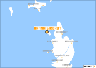
Ban Mai Si Ko Kut (Trat, Thailand)Ban Mai Si Ko Kut is a town in the Trat region of Thailand. An overview map of the region around Ban Mai Si Ko Kut is displayed below.
regional and 3d topo map of Ban Mai Si Ko Kut, Thailand ::
Ban Mai Si Ko Kut airports ::
The nearest airport is UTP - Rayong U Taphao Intl, located 196.0 km north west of Ban Mai Si Ko Kut.
Other airports nearby include REP - Siem-reap Siem Reap (234.4 km north east), Nearby towns ::
Ban Lak Uan (4.1km south east) //
Ban Ao Salat (5.4km east) //
Ban Ta Chan (7.4km south) //
Ban Hin Dam (7.6km south) //
Ban Khlong Mat (7.6km south) //
[all distances 'as the bird flies' and approximate] 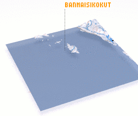 Places with similar names to Ban Mai Si Ko Kut, Thailand :: Disclaimer :: Information on this page comes without warranty of any kind |
||
|
Where is Ban Mai Si Ko Kut? Elevation and coordinates ::
Latitude (lat): 11°43'0"N Longitude (lon): 102°31'0"E
(map arrows pan, magnifying glasses zoom) |
||
|
Visiting Ban Mai Si Ko Kut? Hotel/Accommodation ::
Book a hotel in Ban Mai Si Ko Kut Travel Guide ::
Buy a travel guide for Thailand rental cars ::
car rental offers GPS waypoint ::
download a GPX waypoint (PoI) of Ban Mai Si Ko Kut for your GPS receiver
|
||