|
search place name
|
||
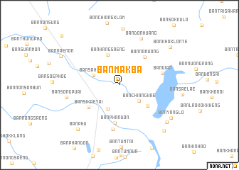
Ban Mak Ba (Udon Thani, Thailand)Ban Mak Ba is a town in the Udon Thani region of Thailand. An overview map of the region around Ban Mak Ba is displayed below.
regional and 3d topo map of Ban Mak Ba, Thailand ::
Ban Mak Ba airports ::
The nearest airport is UTH - Udon Thani, located 29.1 km north west of Ban Mak Ba.
Other airports nearby include VTE - Vientiane Wattay Intl (98.0 km north west), SNO - Sakon Nakhon (121.4 km east), LOE - Loei (136.1 km west), ZVK - Savannakhet (202.7 km east), Nearby towns ::
Ban Chiang Wae (3.9km south east) //
Ban Dong Ruang (4.1km south west) //
Ban Sam Phat (4.2km west) //
Ban Wang Saeng (5.1km north) //
Ban Don Kloi (5.3km south east) //
Ban Muang Pang (5.3km south east) //
Ban Na Muang (5.8km north east) //
Ban Phan Don (6.0km south) //
Ban Si Kae Yai (5.9km south west) //
Ban Diam (6.7km east) //
Ban Phan Don (7.1km south) //
Ban Don Muang (8.1km north east) //
Ban Song Puai (8.2km west) //
Ban Yang Lo (9.2km south east) //
Ban Phu (9.4km south west) //
Ban Yang Lo (9.3km south east) //
Ban Khok Lante (9.7km north east) //
Ban Don Ngoen (9.9km south east) //
[all distances 'as the bird flies' and approximate] 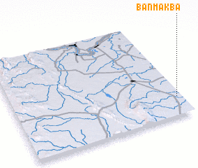 Places with similar names to Ban Mak Ba, Thailand ::
Disclaimer :: Information on this page comes without warranty of any kind |
||
|
Where is Ban Mak Ba? Elevation and coordinates ::
Latitude (lat): 17°11'48"N Longitude (lon): 102°58'39"E
Elevation (approx.): 180m (map arrows pan, magnifying glasses zoom) |
||
|
Visiting Ban Mak Ba? Hotel/Accommodation ::
Book a hotel in Ban Mak Ba Travel Guide ::
Buy a travel guide for Thailand rental cars ::
car rental offers GPS waypoint ::
download a GPX waypoint (PoI) of Ban Mak Ba for your GPS receiver
|
||