|
search place name
|
||
Ban Na Ham (Nong Khai, Thailand)Ban Na Ham is a town in the Nong Khai region of Thailand. An overview map of the region around Ban Na Ham is displayed below.
regional and 3d topo map of Ban Na Ham, Thailand ::

Ban Na Ham airports ::
The nearest airport is VTE - Vientiane Wattay Intl, located 78.3 km west of Ban Na Ham.
Other airports nearby include UTH - Udon Thani (85.4 km south west), SNO - Sakon Nakhon (122.7 km south east), LOE - Loei (178.0 km west), ZVK - Savannakhet (220.9 km south east), Nearby towns ::
Ban Fao Rai (4.6km north west) //
Ban Thung (4.8km south) //
Ban Nong Luang (5.6km north west) //
Ban Soem (5.9km south) //
Ban Baeng (6.0km west) //
Ban Sam Nong (6.4km north east) //
Ban Na Dok Mai (6.8km north east) //
Ban Baeng Noi (6.9km north west) //
Ban Lao Charoen (7.0km east) //
Ban Na Di (7.1km east) //
Ban Chap Mai (9.0km north east) //
[all distances 'as the bird flies' and approximate] 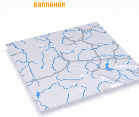 Places with similar names to Ban Na Ham, Thailand ::
// Beni Hayyoum (MA)
// Beienheim (DE)
// Boinham (DE)
// Benham (US)
// Ban A Ham (TH)
// Ban A Ham (TH)
// Ban Hom (TH)
// Ban Hom (TH)
// Ban Hom (TH)
// Ban Huai Ma (TH)
Disclaimer :: Information on this page comes without warranty of any kind |
||
|
Where is Ban Na Ham? Elevation and coordinates ::
Latitude (lat): 17°58'48"N Longitude (lon): 103°18'10"E
Elevation (approx.): 164m (map arrows pan, magnifying glasses zoom) |
||
|
Visiting Ban Na Ham? Hotel/Accommodation ::
Book a hotel in Ban Na Ham Travel Guide ::
Buy a travel guide for Thailand rental cars ::
car rental offers GPS waypoint ::
download a GPX waypoint (PoI) of Ban Na Ham for your GPS receiver
|
||