|
search place name
|
||
Ban Na Lup (Nakhon Phanom, Thailand)Ban Na Lup is a town in the Nakhon Phanom region of Thailand. An overview map of the region around Ban Na Lup is displayed below.
regional and 3d topo map of Ban Na Lup, Thailand ::

Ban Na Lup airports ::
The nearest airport is SNO - Sakon Nakhon, located 65.2 km west of Ban Na Lup.
Other airports nearby include ZVK - Savannakhet (91.7 km south), UTH - Udon Thani (203.2 km west), Nearby towns ::
Ban Hua Phon (0.0km north) //
Changwat Nakhon Phanom (2.6km south east) //
Ban Nong Yat (2.6km south east) //
Ban Tha Khwai (2.6km south east) //
Ban Nong Yat (3.5km east) //
Ban Sang Hin (3.7km north) //
Ban Nong Bua (4.0km south east) //
Ban Don Muang (5.6km west) //
Ban Phai Lom Nua (6.6km north east) //
Ban Suk Kasem (6.6km south east) //
Ban Na Chok (7.3km east) //
Ban Samran Nua (7.6km north) //
Ban Tha Khwai (7.7km north east) //
Ban Kham That (8.2km south east) //
Ban Nong Saeng (8.0km north east) //
[all distances 'as the bird flies' and approximate] 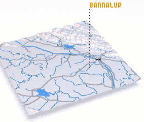 Places with similar names to Ban Na Lup, Thailand ::
// Benolpe (DE)
// Benolpe (DE)
// Ban Lao Pao (TH)
// Ban La-up (TH)
// Ban Liap (TH)
// Ban Liap (TH)
// Ban Lup (TH)
// Ban Lup Pho (TH)
// Benillup (ES)
// Bonelipu (ID)
Disclaimer :: Information on this page comes without warranty of any kind |
||
|
Where is Ban Na Lup? Elevation and coordinates ::
Latitude (lat): 17°23'0"N Longitude (lon): 104°42'0"E
Elevation (approx.): 146m (map arrows pan, magnifying glasses zoom) |
||
|
Visiting Ban Na Lup? Hotel/Accommodation ::
Book a hotel in Ban Na Lup Travel Guide ::
Buy a travel guide for Thailand rental cars ::
car rental offers GPS waypoint ::
download a GPX waypoint (PoI) of Ban Na Lup for your GPS receiver
|
||