|
search place name
|
||
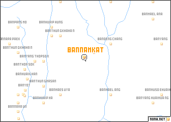
Ban Nam Kat (Mae Hong Son, Thailand)Ban Nam Kat is a town in the Mae Hong Son region of Thailand. An overview map of the region around Ban Nam Kat is displayed below.
regional and 3d topo map of Ban Nam Kat, Thailand ::
Ban Nam Kat airports ::
The nearest airport is MOG - Mong Hsat, located 166.6 km north east of Ban Nam Kat.
Other airports nearby include HEH - Heho (193.1 km north west), LPT - Lampang (202.3 km south east), THL - Tachilek Tachileik (222.3 km north east), KET - Kengtung (257.0 km north east), Nearby towns ::
Ban Mae Suya (2.5km north east) //
Ban Oeng Chang (6.4km north east) //
Ban Mai (6.4km north east) //
Ban Thung Kha Han (7.6km north west) //
Ban Thung Kha Han (8.9km north west) //
Ban Khong Luang (9.1km south east) //
Ban Mae Lang (9.1km south east) //
Ban Mae Suya (9.1km south west) //
Ban Kong (9.1km south west) //
Ban Huai Phung (10.2km north west) //
[all distances 'as the bird flies' and approximate]  Places with similar names to Ban Nam Kat, Thailand ::
// Beni Mkoud (MA)
// Ban Mae Kaeo Tai (TH)
// Ban Mae Kut (TH)
// Ban Mae Kut (TH)
// Ban Mak Duai (TH)
// Ban Mok Tao (TH)
// Ban Mua Ket (TH)
// Ban Mokdou (LA)
// Ban Mokdou (LA)
// Ban Môkdou (LA)
Disclaimer :: Information on this page comes without warranty of any kind |
||
|
Where is Ban Nam Kat? Elevation and coordinates ::
Latitude (lat): 19°30'0"N Longitude (lon): 98°5'0"E
Elevation (approx.): 913m (map arrows pan, magnifying glasses zoom) |
||
|
Visiting Ban Nam Kat? Hotel/Accommodation ::
Book a hotel in Ban Nam Kat Travel Guide ::
Buy a travel guide for Thailand rental cars ::
car rental offers GPS waypoint ::
download a GPX waypoint (PoI) of Ban Nam Kat for your GPS receiver
|
||