|
search place name
|
||
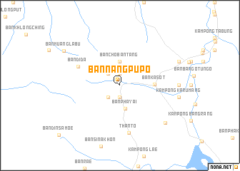
Ban Nang Pupo (Yala, Thailand)Ban Nang Pupo is a town in the Yala region of Thailand. An overview map of the region around Ban Nang Pupo is displayed below.
regional and 3d topo map of Ban Nang Pupo, Thailand ::
Ban Nang Pupo airports ::
The nearest airport is PAN - Pattani, located 61.1 km north of Ban Nang Pupo.
Other airports nearby include NAW - Narathiwat (71.2 km north east), AOR - Alor Setar Sultan Abdul Halim (85.2 km west), HDY - Songkhla Hat Yai Intl (115.4 km north west), KBR - Kota Bahru Sultan Ismail Petra (124.9 km east), Nearby towns ::
Ban Ban Nang Bu Bo (1.1km north) //
Ban Tham Muang Tang Kradang (1.9km south) //
Ban Chin Bayo (1.9km north) //
Than To (2.6km south west) //
Ban Butong (2.6km north west) //
Ban Cho Ban Tang (3.7km north) //
Ban Pha Yai (3.7km south) //
Ban Ka Sot (5.3km east) //
Ban Di Da (7.2km north west) //
Than To (7.5km south) //
Ban Kala Pho (9.2km south east) //
Ban Muang La Bu (10.2km north west) //
[all distances 'as the bird flies' and approximate]  Places with similar names to Ban Nang Pupo, Thailand ::
// Ban Nongpapao (LA)
// Ban Nongpop (LA)
Disclaimer :: Information on this page comes without warranty of any kind |
||
|
Where is Ban Nang Pupo? Elevation and coordinates ::
Latitude (lat): 6°14'0"N Longitude (lon): 101°10'0"E
Elevation (approx.): 139m (map arrows pan, magnifying glasses zoom) |
||
|
Visiting Ban Nang Pupo? Hotel/Accommodation ::
Book a hotel in Ban Nang Pupo Travel Guide ::
Buy a travel guide for Thailand rental cars ::
car rental offers GPS waypoint ::
download a GPX waypoint (PoI) of Ban Nang Pupo for your GPS receiver
|
||