|
search place name
|
||
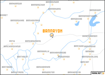
Ban Na Yom (Amnat Charoen, Thailand)Ban Na Yom is a town in the Amnat Charoen region of Thailand. An overview map of the region around Ban Na Yom is displayed below.
regional and 3d topo map of Ban Na Yom, Thailand ::
Ban Na Yom airports ::
The nearest airport is ZVK - Savannakhet, located 82.2 km north of Ban Na Yom.
Other airports nearby include SNO - Sakon Nakhon (154.4 km north), PKZ - Pakse (157.8 km south east), UTH - Udon Thani (250.3 km north west), Nearby towns ::
Ban Na Yia (2.8km north east) //
Ban Na Mo Ma (5.2km west) //
Ban Kaeng Kathin (5.9km north west) //
Ban Kham Sang Bo (6.5km south) //
Ban Nam Plik (6.7km south west) //
Ban Siang Pheng (7.1km west) //
Ban Khok Na Ko (8.5km north west) //
Ban Don Moei (8.7km south east) //
Ban Sok Kao (10.1km north east) //
[all distances 'as the bird flies' and approximate] 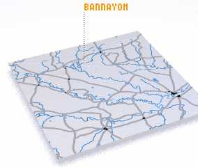 Places with similar names to Ban Na Yom, Thailand ::
// Ban Na Yai Am (TH)
// Ban Na Yom (TH)
// Ban Na Yom (TH)
// Ban Na Yom (TH)
// Ban Na Yom (TH)
// Ban Ya Mi (TH)
// Ban Ya Mu (TH)
// Benyom (ID)
// Bunyama (GH)
// Bunyum (GH)
Disclaimer :: Information on this page comes without warranty of any kind |
||
|
Where is Ban Na Yom? Elevation and coordinates ::
Latitude (lat): 15°51'11"N Longitude (lon): 104°30'47"E
Elevation (approx.): 152m (map arrows pan, magnifying glasses zoom) |
||
|
Visiting Ban Na Yom? Hotel/Accommodation ::
Book a hotel in Ban Na Yom Travel Guide ::
Buy a travel guide for Thailand rental cars ::
car rental offers GPS waypoint ::
download a GPX waypoint (PoI) of Ban Na Yom for your GPS receiver
|
||