|
search place name
|
||
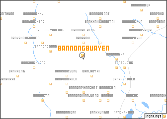
Ban Nong Bua Yen (Khon Kaen, Thailand)Ban Nong Bua Yen is a town in the Khon Kaen region of Thailand. An overview map of the region around Ban Nong Bua Yen is displayed below.
regional and 3d topo map of Ban Nong Bua Yen, Thailand ::
Ban Nong Bua Yen airports ::
The nearest airport is UTH - Udon Thani, located 132.1 km north of Ban Nong Bua Yen.
Other airports nearby include NAK - Nakhon Ratchasima Khorat (149.6 km south), LOE - Loei (155.3 km north west), VTE - Vientiane Wattay Intl (194.5 km north), SNO - Sakon Nakhon (205.8 km north east), Nearby towns ::
Ban Pa Du (3.7km north) //
Ban Lao Yai (4.1km south east) //
Ban Nong Ya Plong (5.1km north east) //
Ban Khok Sung (5.1km south west) //
Ban Huai Laeng (5.6km north) //
Ban Phon Phek (6.6km south west) //
Ban Nong Hai (7.1km east) //
Ban Non Phan Chat (7.4km south) //
Ban Chaeng (7.4km east) //
Ban Nong Song Hong (7.4km west) //
Ban Hin Taek (8.2km south west) //
Ban Kham Khaen Tai (8.2km north east) //
Ban Na Kha (9.1km south east) //
Ban Nong Ya Plong (9.0km north west) //
Ban Na Ngam (9.0km south west) //
[all distances 'as the bird flies' and approximate] 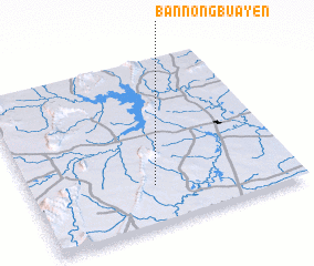 Places with similar names to Ban Nong Bua Yen, Thailand :: Disclaimer :: Information on this page comes without warranty of any kind |
||
|
Where is Ban Nong Bua Yen? Elevation and coordinates ::
Latitude (lat): 16°14'0"N Longitude (lon): 102°28'0"E
Elevation (approx.): 211m (map arrows pan, magnifying glasses zoom) |
||
|
Visiting Ban Nong Bua Yen? Hotel/Accommodation ::
Book a hotel in Ban Nong Bua Yen Travel Guide ::
Buy a travel guide for Thailand rental cars ::
car rental offers GPS waypoint ::
download a GPX waypoint (PoI) of Ban Nong Bua Yen for your GPS receiver
|
||