|
search place name
|
||
Ban Nong Chong Long (Surin, Thailand)Ban Nong Chong Long is a town in the Surin region of Thailand. An overview map of the region around Ban Nong Chong Long is displayed below.
regional and 3d topo map of Ban Nong Chong Long, Thailand ::

Ban Nong Chong Long airports ::
The nearest airport is REP - Siem-reap Siem Reap, located 128.0 km south of Ban Nong Chong Long.
Other airports nearby include PKZ - Pakse (200.6 km east), NAK - Nakhon Ratchasima Khorat (213.0 km west), Nearby towns ::
Ban Sangkae (1.9km north) //
Ban Ta Nuai (3.7km north) //
Ban Bok (4.1km north east) //
Ban Thai Doem (4.0km north west) //
Ban Lalom (5.4km east) //
Ban Khanun (5.4km west) //
Ban Ta-ngok (5.4km east) //
Ban Kan Luang (5.4km east) //
Ban Ta Wang (5.4km west) //
Ban Ka-ngok (5.4km west) //
Ban Saruan (5.6km south) //
Ban Ramat Kho (6.5km south west) //
Ban Tamuan (6.5km south east) //
Ban Lalom (9.1km north east) //
Ban Phra Kaeo (10.3km north west) //
[all distances 'as the bird flies' and approximate] 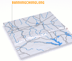 Places with similar names to Ban Nong Chong Long, Thailand ::
// Ban Nong Chang Long (TH)
// Ban Nong Chang Long (TH)
Disclaimer :: Information on this page comes without warranty of any kind |
||
|
Where is Ban Nong Chong Long? Elevation and coordinates ::
Latitude (lat): 14°33'0"N Longitude (lon): 104°1'0"E
Elevation (approx.): 196m (map arrows pan, magnifying glasses zoom) |
||
|
Visiting Ban Nong Chong Long? Hotel/Accommodation ::
Book a hotel in Ban Nong Chong Long Travel Guide ::
Buy a travel guide for Thailand rental cars ::
car rental offers GPS waypoint ::
download a GPX waypoint (PoI) of Ban Nong Chong Long for your GPS receiver
|
||