|
search place name
|
||
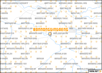
Ban Nong Din Daeng (Nakhon Pathom, Thailand)Ban Nong Din Daeng is a town in the Nakhon Pathom region of Thailand. An overview map of the region around Ban Nong Din Daeng is displayed below.
regional and 3d topo map of Ban Nong Din Daeng, Thailand ::
Ban Nong Din Daeng airports ::
The nearest airport is BKK - Bangkok Intl, located 66.8 km east of Ban Nong Din Daeng.
Other airports nearby include HHQ - Prachuap Khiri Khan Hua Hin (128.9 km south), UTP - Rayong U Taphao Intl (165.0 km south east), MGZ - Myeik (212.1 km south west), Nearby towns ::
Ban Nong Pak Rong (1.9km north) //
Ban Nong Chok (1.8km east) //
Ban Wang Yen (1) (2.6km south east) //
Ban Nong Sua (1) (2.6km south west) //
Ban Nong Bua Loi (2.6km south west) //
Ban Thung Yo (2.6km north east) //
Ban Phrong Madua (2.6km north west) //
Ban Khlong Sa Ket (2.6km south west) //
Ban Lam Phaya (1) (3.6km east) //
Ban Lat Pla Khao (1) (4.0km south east) //
Ban Rai (4.1km north west) //
Bani Sa Kathiam (4.1km south west) //
Ban Wa En (5.2km north west) //
Ban Bang Khaem (5.2km south east) //
Ban Huai Luk (5.2km south west) //
Ban Thung Faek (5.2km south west) //
Ban Hua Na Pa (5.4km east) //
Ban Rang Khoi (5.4km west) //
Ban Nong Takhaeng (5.4km west) //
Ban Nong Sa Nang (5.7km west) //
Ban Khlong Bang Tan (5.7km west) //
Nakhon Pathom (5.7km east) //
Ban Nong Kha Yang (5.7km east) //
Ban Mai (1) (5.7km east) //
Ban Nong Nang Chae (5.8km north) //
Ban Pin Klieo (6.6km north east) //
Ban Nong Ma (6.6km north west) //
Ban Wang Taku (2) (6.6km north east) //
Ban Hup Rak (2) (6.6km north west) //
[all distances 'as the bird flies' and approximate]  Places with similar names to Ban Nong Din Daeng, Thailand ::
Disclaimer :: Information on this page comes without warranty of any kind |
||
|
Where is Ban Nong Din Daeng? Elevation and coordinates ::
Latitude (lat): 13°48'0"N Longitude (lon): 100°0'0"E
Elevation (approx.): 9m (map arrows pan, magnifying glasses zoom) |
||
|
Visiting Ban Nong Din Daeng? Hotel/Accommodation ::
Book a hotel in Ban Nong Din Daeng Travel Guide ::
Buy a travel guide for Thailand rental cars ::
car rental offers GPS waypoint ::
download a GPX waypoint (PoI) of Ban Nong Din Daeng for your GPS receiver
|
||