|
search place name
|
||
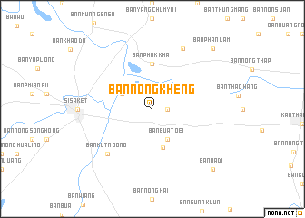
Ban Nong Kheng (Nakhon Sawan, Thailand)Ban Nong Kheng is a town in the Nakhon Sawan region of Thailand. An overview map of the region around Ban Nong Kheng is displayed below.
regional and 3d topo map of Ban Nong Kheng, Thailand ::
Ban Nong Kheng airports ::
The nearest airport is PKZ - Pakse, located 146.7 km east of Ban Nong Kheng.
Other airports nearby include ZVK - Savannakhet (163.5 km north), REP - Siem-reap Siem Reap (199.7 km south), Nearby towns ::
Ban Phon Khwao (1.8km east) //
Ban Non Chan (4.0km north west) //
Ban Bua Toei (4.1km south east) //
Ban Bua Toei (4.9km south) //
Ban Phak Kha (5.6km north) //
Ban Kut Ngong (7.7km south west) //
Ban Lin Fa (8.2km north east) //
Ban Phan Lam (10.3km north east) //
Ban Na Di (10.3km south east) //
[all distances 'as the bird flies' and approximate] 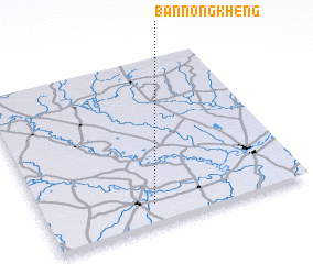 Places with similar names to Ban Nong Kheng, Thailand ::
// Ban Nong Khai Nok (TH)
// Ban Nong Khanak (TH)
// Ban Nong Khanak (TH)
// Ban Nong Khang (TH)
// Ban Nong Khang (TH)
// Ban Nong Khang (TH)
// Ban Nong Khang (TH)
// Ban Nong Khao Ngai (TH)
// Ban Nong Khao Nok (TH)
// Ban Nong Kheng (TH)
Disclaimer :: Information on this page comes without warranty of any kind |
||
|
Where is Ban Nong Kheng? Elevation and coordinates ::
Latitude (lat): 15°7'0"N Longitude (lon): 104°25'0"E
Elevation (approx.): 126m (map arrows pan, magnifying glasses zoom) |
||
|
Visiting Ban Nong Kheng? Hotel/Accommodation ::
Book a hotel in Ban Nong Kheng Travel Guide ::
Buy a travel guide for Thailand rental cars ::
car rental offers GPS waypoint ::
download a GPX waypoint (PoI) of Ban Nong Kheng for your GPS receiver
|
||