|
search place name
|
||
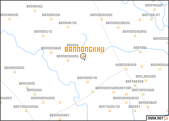
Ban Nong Khu (Ubon Ratchathani, Thailand)Ban Nong Khu is a town in the Ubon Ratchathani region of Thailand. An overview map of the region around Ban Nong Khu is displayed below.
regional and 3d topo map of Ban Nong Khu, Thailand ::
Ban Nong Khu airports ::
The nearest airport is ZVK - Savannakhet, located 113.8 km north of Ban Nong Khu.
Other airports nearby include PKZ - Pakse (129.4 km east), SNO - Sakon Nakhon (192.5 km north), UTH - Udon Thani (285.6 km north west), Nearby towns ::
Ban Phu (3.5km north west) //
Ban Nong Hang (3.6km west) //
Ban Nam Om (4.0km north east) //
Ban Na Rai Yai (4.8km south) //
Ban Don Daeng Yai (7.0km south) //
Ban Nong Bua (7.4km west) //
Ban Phai Yai (8.2km north west) //
Ban Phon Muang Mathan (9.3km south east) //
Ban Nong Saeng (10.3km north east) //
[all distances 'as the bird flies' and approximate] 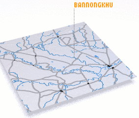 Places with similar names to Ban Nong Khu, Thailand ::
// Ban Ang Khai (TH)
// Ban Nong Kai Hoei (TH)
// Ban Nong Kha (TH)
// Ban Nong Kha (TH)
// Ban Nong Kha (TH)
// Ban Nong Kha (TH)
// Ban Nong Kha (TH)
// Ban Nong Kha (TH)
// Ban Nong Kha (TH)
// Ban Nong Kha (TH)
Disclaimer :: Information on this page comes without warranty of any kind |
||
|
Where is Ban Nong Khu? Elevation and coordinates ::
Latitude (lat): 15°32'0"N Longitude (lon): 104°39'0"E
Elevation (approx.): 130m (map arrows pan, magnifying glasses zoom) |
||
|
Visiting Ban Nong Khu? Hotel/Accommodation ::
Book a hotel in Ban Nong Khu Travel Guide ::
Buy a travel guide for Thailand rental cars ::
car rental offers GPS waypoint ::
download a GPX waypoint (PoI) of Ban Nong Khu for your GPS receiver
|
||