|
search place name
|
||
Ban Nong Leng (Chon Buri, Thailand)Ban Nong Leng is a town in the Chon Buri region of Thailand. An overview map of the region around Ban Nong Leng is displayed below.
regional and 3d topo map of Ban Nong Leng, Thailand ::

Ban Nong Leng airports ::
The nearest airport is UTP - Rayong U Taphao Intl, located 53.9 km south of Ban Nong Leng.
Other airports nearby include BKK - Bangkok Intl (94.6 km north west), HHQ - Prachuap Khiri Khan Hua Hin (131.3 km south west), NAK - Nakhon Ratchasima Khorat (225.8 km north east), Nearby towns ::
Ban Nong Phak Nam (4.1km north west) //
Ban Nong Kho (4.1km south east) //
Ban Chom Phon (4.1km south east) //
Ban Huai Kru (5.2km north west) //
Ban Wang Hin (5.7km west) //
Ban Nong I Bu (5.7km west) //
Ban Na Phrao (7.2km west) //
Ban Huai Yai Phrom (7.2km west) //
Ban Chak Makham (7.5km west) //
Ban Tha Sai (7.6km north) //
Ban Nong Kham (7.8km south west) //
Ban Huai Kum (1) (8.2km north west) //
Ban Chak Kho (8.1km south west) //
Ban Hup Bon (8.1km south east) //
Ban Rai (10.3km south west) //
[all distances 'as the bird flies' and approximate] 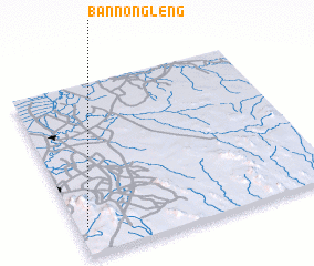 Places with similar names to Ban Nong Leng, Thailand ::
// Ban Nang Loeng (TH)
// Ban Nang Long (TH)
// Ban Noen Klaeng (TH)
// Ban Noen Klang (TH)
// Ban Noen Klang (TH)
// Ban Nong Laeng (TH)
// Ban Nong Laeng (TH)
// Ban Nong Ling (TH)
// Ban Nong Luang (TH)
// Ban Nong Luang (TH)
Disclaimer :: Information on this page comes without warranty of any kind |
||
|
Where is Ban Nong Leng? Elevation and coordinates ::
Latitude (lat): 13°10'0"N Longitude (lon): 101°2'0"E
Elevation (approx.): 85m (map arrows pan, magnifying glasses zoom) |
||
|
Visiting Ban Nong Leng? Hotel/Accommodation ::
Book a hotel in Ban Nong Leng Travel Guide ::
Buy a travel guide for Thailand rental cars ::
car rental offers GPS waypoint ::
download a GPX waypoint (PoI) of Ban Nong Leng for your GPS receiver
|
||