|
search place name
|
||
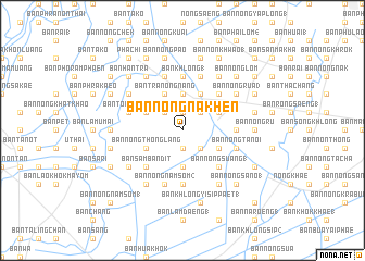
Ban Nong Na Khen (Phra Nakhon Si Ayutthaya, Thailand)Ban Nong Na Khen is a town in the Phra Nakhon Si Ayutthaya region of Thailand. An overview map of the region around Ban Nong Na Khen is displayed below.
regional and 3d topo map of Ban Nong Na Khen, Thailand ::
Ban Nong Na Khen airports ::
The nearest airport is BKK - Bangkok Intl, located 54.9 km south of Ban Nong Na Khen.
Other airports nearby include NAK - Nakhon Ratchasima Khorat (153.9 km north east), UTP - Rayong U Taphao Intl (190.2 km south), HHQ - Prachuap Khiri Khan Hua Hin (212.5 km south west), Nearby towns ::
Ban Nong Ai Dang (1.9km south) //
Ban Nong Rua (1) (1.9km north) //
Ban Luang (2.6km south east) //
Ban Khok Krachan (1) (2.6km north east) //
Ban Rasom (2.6km north east) //
Ban Nong Nang (2.6km north west) //
Ban Nong Mai Sung (3.7km south) //
Ban Nong Ngu Luam (3.7km north) //
Ban Hua Thong (4.0km south east) //
Ban Nong Ta Lo (1) (4.0km north east) //
Ban Khon Changok (4.0km north east) //
Ban Nong Phlap (1) (4.1km north east) //
Ban Khok Daeng (4.1km north east) //
Ban Nong Thong Lang (4.0km south west) //
Ban Tra Nong Nang (4.1km north west) //
Ban Suan Khwan (4.0km north west) //
Ban Nong Pling (1) (5.2km south east) //
Ban Nong Suang (1) (5.2km south east) //
Ban Nong No (5.2km north east) //
Ban Nong Phai (2) (5.2km north east) //
Ban Sam Bandit (5.2km south west) //
Ban Khok Khae (5.4km east) //
Ban Khlong (1) (5.6km north) //
Ban Khok Pho (2) (5.6km south) //
Ban Huai Ba (1) (5.8km north) //
Ban Nong Ta Noi (5.7km east) //
Ban Ton Makham (5.7km west) //
Ban Khoi Thon (2) (5.7km west) //
Ban Khok Muang (2) (5.8km north) //
[all distances 'as the bird flies' and approximate] 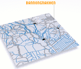 Places with similar names to Ban Nong Na Khen, Thailand ::
// Ban Nong Nok Khian (TH)
// Ban Nong Nok Khian (TH)
// Ban Nong Nok Khian (TH)
// Ban Nong Nok Khian (TH)
// Ban Nong Nok Khian (TH)
Disclaimer :: Information on this page comes without warranty of any kind |
||
|
Where is Ban Nong Na Khen? Elevation and coordinates ::
Latitude (lat): 14°23'0"N Longitude (lon): 100°46'0"E
Elevation (approx.): 3m (map arrows pan, magnifying glasses zoom) |
||
|
Visiting Ban Nong Na Khen? Hotel/Accommodation ::
Book a hotel in Ban Nong Na Khen Travel Guide ::
Buy a travel guide for Thailand rental cars ::
car rental offers GPS waypoint ::
download a GPX waypoint (PoI) of Ban Nong Na Khen for your GPS receiver
|
||