|
search place name
|
||
Ban Nong Nam Khun (Buriram, Thailand)Ban Nong Nam Khun is a town in the Buriram region of Thailand. An overview map of the region around Ban Nong Nam Khun is displayed below.
regional and 3d topo map of Ban Nong Nam Khun, Thailand ::

Ban Nong Nam Khun airports ::
The nearest airport is NAK - Nakhon Ratchasima Khorat, located 130.7 km west of Ban Nong Nam Khun.
Other airports nearby include REP - Siem-reap Siem Reap (204.8 km south), ZVK - Savannakhet (220.6 km north east), Nearby towns ::
Ban Na Kham (2.6km north east) //
Ban Prikrin (3.7km south) //
Ban Tabaeng (5.2km south west) //
Ban Muang Kae (5.4km east) //
Ban A Kian (5.8km south) //
Ban Arang (6.5km south west) //
Ban Ron Thong (7.2km west) //
Ban Don Yang (7.6km south) //
Ban Nong Yai (7.6km south) //
Ban Sako Sai (7.6km north) //
Ban Nong Kap (8.1km south east) //
Ban Hua Chang (8.1km north east) //
Ban Palat Pluk (8.1km south west) //
Ban Prahat (9.2km south west) //
Ban Sawai Ta Nguan (9.2km south east) //
Ban Chaluai (9.2km north west) //
[all distances 'as the bird flies' and approximate] 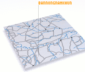 Places with similar names to Ban Nong Nam Khun, Thailand ::
// Ban Nong Nam Khan (TH)
// Ban Nong Nam Khun (TH)
// Ban Nong Nam Khun (TH)
// Ban Nong Nam Khun (TH)
// Ban Nong Nam Khun (TH)
// Ban Nong Nam Khun (TH)
// Ban Nong Nam Khun (TH)
// Ban Nong Nam Khun (TH)
// Ban Nong Nam Khun (TH)
Disclaimer :: Information on this page comes without warranty of any kind |
||
|
Where is Ban Nong Nam Khun? Elevation and coordinates ::
Latitude (lat): 15°11'0"N Longitude (lon): 103°16'0"E
Elevation (approx.): 165m (map arrows pan, magnifying glasses zoom) |
||
|
Visiting Ban Nong Nam Khun? Hotel/Accommodation ::
Book a hotel in Ban Nong Nam Khun Travel Guide ::
Buy a travel guide for Thailand rental cars ::
car rental offers GPS waypoint ::
download a GPX waypoint (PoI) of Ban Nong Nam Khun for your GPS receiver
|
||