|
search place name
|
||
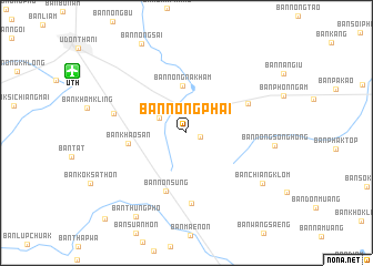
Ban Nong Phai (Udon Thani, Thailand)Ban Nong Phai is a town in the Udon Thani region of Thailand. An overview map of the region around Ban Nong Phai is displayed below.
regional and 3d topo map of Ban Nong Phai, Thailand ::
Ban Nong Phai airports ::
The nearest airport is UTH - Udon Thani, located 12.6 km north west of Ban Nong Phai.
Other airports nearby include VTE - Vientiane Wattay Intl (80.7 km north west), LOE - Loei (124.8 km west), SNO - Sakon Nakhon (131.4 km east), ZVK - Savannakhet (216.6 km south east), Nearby towns ::
Ban Nong Wa (1.4km east) //
Ban I Lian (3.0km north west) //
Ban Nong Na Kham (4.7km north) //
Ban Khao San (5.6km west) //
Ban Non Sung (6.2km south) //
Ban Nikhom Nong Tan (6.6km north east) //
Ban Nong Takai (7.1km south) //
Ban Dong Kheng (7.2km west) //
Ban Nong Song Hong (8.6km east) //
Ban Chiang Klom (8.9km south east) //
Ban Thung Pho (9.7km south west) //
Ban Khok Si Samran (11.7km south west) //
[all distances 'as the bird flies' and approximate] 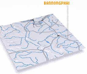 Places with similar names to Ban Nong Phai, Thailand ::
// Ban Ang Phai (TH)
// Ban Nong Fa (TH)
// Ban Nong Pha (TH)
// Ban Nong Pha (TH)
// Ban Nong Phai (TH)
// Ban Nong Phai (TH)
// Ban Nong Phai (TH)
// Ban Nong Phai (TH)
// Ban Nong Phai (TH)
// Ban Nong Phai (TH)
Disclaimer :: Information on this page comes without warranty of any kind |
||
|
Where is Ban Nong Phai? Elevation and coordinates ::
Latitude (lat): 17°19'49"N Longitude (lon): 102°53'29"E
Elevation (approx.): 190m (map arrows pan, magnifying glasses zoom) |
||
|
Visiting Ban Nong Phai? Hotel/Accommodation ::
Book a hotel in Ban Nong Phai Travel Guide ::
Buy a travel guide for Thailand rental cars ::
car rental offers GPS waypoint ::
download a GPX waypoint (PoI) of Ban Nong Phai for your GPS receiver
|
||