|
search place name
|
||
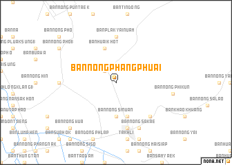
Ban Nong Phang Phuai (Nakhon Sawan, Thailand)Ban Nong Phang Phuai is a town in the Nakhon Sawan region of Thailand. An overview map of the region around Ban Nong Phang Phuai is displayed below.
regional and 3d topo map of Ban Nong Phang Phuai, Thailand ::
Ban Nong Phang Phuai airports ::
The nearest airport is BKK - Bangkok Intl, located 159.9 km south of Ban Nong Phang Phuai.
Other airports nearby include PHS - Phitsanulok (160.5 km north), NAK - Nakhon Ratchasima Khorat (192.7 km east), Nearby towns ::
Ban Hua Wai (2.6km north west) //
Ban Nong Si Nuan (5.6km south) //
Ban Huai Khot (5.8km north) //
Ban Khao Bai Mai (5.8km south) //
Ban Plak Yai Nuam (7.4km north) //
Ban Hua Khao (7.6km south) //
Ban Chon Dua (7.7km south east) //
Ban Nong Sakae (8.2km south east) //
Ban Rong Wua (10.3km south west) //
[all distances 'as the bird flies' and approximate]  Places with similar names to Ban Nong Phang Phuai, Thailand ::
// Ban Nong Phaeng Phuai (TH)
// Ban Nong Phaeng Phuai (TH)
// Ban Nong Phaengphuai (TH)
// Ban Nong Phangphuai (TH)
Disclaimer :: Information on this page comes without warranty of any kind |
||
|
Where is Ban Nong Phang Phuai? Elevation and coordinates ::
Latitude (lat): 15°20'0"N Longitude (lon): 100°20'0"E
Elevation (approx.): 44m (map arrows pan, magnifying glasses zoom) |
||
|
Visiting Ban Nong Phang Phuai? Hotel/Accommodation ::
Book a hotel in Ban Nong Phang Phuai Travel Guide ::
Buy a travel guide for Thailand rental cars ::
car rental offers GPS waypoint ::
download a GPX waypoint (PoI) of Ban Nong Phang Phuai for your GPS receiver
|
||