|
search place name
|
||
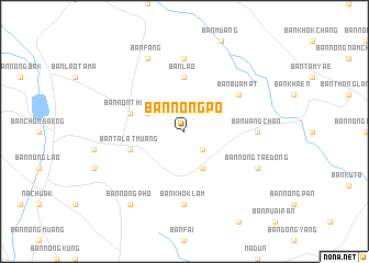
Ban Nong Po (Maha Sarakham, Thailand)Ban Nong Po is a town in the Maha Sarakham region of Thailand. An overview map of the region around Ban Nong Po is displayed below.
regional and 3d topo map of Ban Nong Po, Thailand ::
Ban Nong Po airports ::
The nearest airport is NAK - Nakhon Ratchasima Khorat, located 154.6 km south west of Ban Nong Po.
Other airports nearby include UTH - Udon Thani (174.8 km north), SNO - Sakon Nakhon (180.2 km north east), ZVK - Savannakhet (187.4 km north east), LOE - Loei (233.8 km north west), Nearby towns ::
Ban Nam Kliang (2.6km south east) //
Ban Khok Tao (4.1km south east) //
Ban Nong Kham (4.0km north west) //
Ban Lao (5.6km north) //
Ban Talat Muang (5.7km west) //
Ban Non Thong (5.7km west) //
Ban Bua Mat (6.5km north east) //
Ban Wang Chan (7.1km east) //
Ban Khok Lam (7.4km south) //
Ban Don Ngua (7.4km north) //
Ban Nong Tae Dong (8.0km south east) //
Ban Nong Phai (8.0km south east) //
Ban Fang (8.2km north west) //
Ban Nong Pho (9.1km south west) //
[all distances 'as the bird flies' and approximate]  Places with similar names to Ban Nong Po, Thailand ::
// Ban Nong Pao (TH)
// Ban Nong Pa Oi (TH)
// Ban Nong Po (TH)
// Ban Nong Pu (TH)
// Binangapau (ID)
// Ban Nongpa (LA)
// Ban Nong Pao (LA)
// Ban Nongpoy (LA)
// Binningup (AU)
Disclaimer :: Information on this page comes without warranty of any kind |
||
|
Where is Ban Nong Po? Elevation and coordinates ::
Latitude (lat): 15°51'0"N Longitude (lon): 103°10'0"E
Elevation (approx.): 167m (map arrows pan, magnifying glasses zoom) |
||
|
Visiting Ban Nong Po? Hotel/Accommodation ::
Book a hotel in Ban Nong Po Travel Guide ::
Buy a travel guide for Thailand rental cars ::
car rental offers GPS waypoint ::
download a GPX waypoint (PoI) of Ban Nong Po for your GPS receiver
|
||