|
search place name
|
||
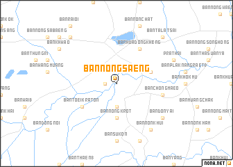
Ban Nong Saeng (Nakhon Ratchasima, Thailand)Ban Nong Saeng is a town in the Nakhon Ratchasima region of Thailand. An overview map of the region around Ban Nong Saeng is displayed below.
regional and 3d topo map of Ban Nong Saeng, Thailand ::
Ban Nong Saeng airports ::
The nearest airport is NAK - Nakhon Ratchasima Khorat, located 91.6 km south west of Ban Nong Saeng.
Other airports nearby include UTH - Udon Thani (210.7 km north), LOE - Loei (241.1 km north west), SNO - Sakon Nakhon (241.5 km north east), Nearby towns ::
Ban Fa Phanang (1.8km west) //
Ban Laloeng Hin (3.7km south) //
Ban Nong Krot (5.6km south) //
Ban Nong I Lum (5.7km east) //
Ban Hua Dong Kheng (6.6km north east) //
Ban Toei Kraton (6.5km south west) //
Ban Chong Maeo (7.4km east) //
Ban Don Yai (9.1km south east) //
Ban Non Khui (9.1km south east) //
Ban Talat Sai (10.3km north east) //
Ban Krathum Rai (10.3km north west) //
[all distances 'as the bird flies' and approximate] 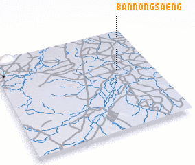 Places with similar names to Ban Nong Saeng, Thailand ::
// Ban Nong Saeng (TH)
// Ban Nong Saeng (TH)
// Ban Nong Saeng (TH)
// Ban Nong Saeng (TH)
// Ban Nong Saeng (TH)
// Ban Nong Saeng (TH)
// Ban Nong Saeng (TH)
// Ban Nong Saeng (TH)
// Ban Nong Saeng (TH)
// Ban Nong Saeng (TH)
Disclaimer :: Information on this page comes without warranty of any kind |
||
|
Where is Ban Nong Saeng? Elevation and coordinates ::
Latitude (lat): 15°29'0"N Longitude (lon): 102°43'0"E
Elevation (approx.): 146m (map arrows pan, magnifying glasses zoom) |
||
|
Visiting Ban Nong Saeng? Hotel/Accommodation ::
Book a hotel in Ban Nong Saeng Travel Guide ::
Buy a travel guide for Thailand rental cars ::
car rental offers GPS waypoint ::
download a GPX waypoint (PoI) of Ban Nong Saeng for your GPS receiver
|
||