|
search place name
|
||
Ban Nong Sam Raet (1) (Sara Buri, Thailand)Ban Nong Sam Raet (1) is a town in the Sara Buri region of Thailand. An overview map of the region around Ban Nong Sam Raet (1) is displayed below.
regional and 3d topo map of Ban Nong Sam Raet (1), Thailand ::

Ban Nong Sam Raet (1) airports ::
The nearest airport is BKK - Bangkok Intl, located 66.7 km south west of Ban Nong Sam Raet (1).
Other airports nearby include NAK - Nakhon Ratchasima Khorat (142.1 km east), UTP - Rayong U Taphao Intl (198.4 km south), HHQ - Prachuap Khiri Khan Hua Hin (224.6 km south west), Nearby towns ::
Ban Nong Ton (1) (1.9km north) //
Ban Huai (2) (1.8km west) //
Ban Nong Hua Pho (1) (1.8km west) //
Ban Nong Krathum (1.8km west) //
Ban San Makha (1.9km south) //
Ban Huai (1) (1.8km east) //
Ban Khok Sawang (1) (2.6km north west) //
Ban Nong Ya Plong (1) (2.6km north west) //
Ban Nong No Tai (1) (2.6km north east) //
Ban Nong Kwang Chon (1) (2.6km south west) //
Ban Muang Wan (1) (2.6km south west) //
Ban Don Dua (2.6km south east) //
Ban Khok Sa-at (3) (3.6km west) //
Ban Phai Lom (4) (3.6km west) //
Ban Khok Kha (3.6km west) //
Ban Nong Pla Kang (3.6km west) //
Ban Tak Daet (3.7km north) //
Ban Khao Din (3.7km north) //
Ban Pa Phai (3.6km east) //
Ban Nong Khuan Chang (1) (3.6km east) //
Ban Nong Chang Lek (1) (3.7km south) //
Ban Nong Chik (1) (3.7km south) //
Ban Bok Noi (3.7km south) //
Ban Khok Wua (2) (4.1km north west) //
Ban Kham (1) (4.1km north west) //
Ban Klan Na (4.1km north west) //
Ban Makham Yong (4.0km south east) //
Ban Nong Saeng (1) (4.1km south west) //
Ban Khlang (4.1km south west) //
[all distances 'as the bird flies' and approximate] 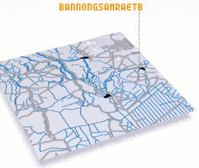 Places with similar names to Ban Nong Sam Raet (1), Thailand :: Disclaimer :: Information on this page comes without warranty of any kind |
||
|
Where is Ban Nong Sam Raet (1)? Elevation and coordinates ::
Latitude (lat): 14°28'0"N Longitude (lon): 100°51'0"E
Elevation (approx.): 13m (map arrows pan, magnifying glasses zoom) |
||
|
Visiting Ban Nong Sam Raet (1)? Hotel/Accommodation ::
Book a hotel in Ban Nong Sam Raet (1) Travel Guide ::
Buy a travel guide for Thailand rental cars ::
car rental offers GPS waypoint ::
download a GPX waypoint (PoI) of Ban Nong Sam Raet (1) for your GPS receiver
|
||