|
search place name
|
||
Ban Nong Sim (Loei, Thailand)Ban Nong Sim is a town in the Loei region of Thailand. An overview map of the region around Ban Nong Sim is displayed below.
regional and 3d topo map of Ban Nong Sim, Thailand ::

Ban Nong Sim airports ::
The nearest airport is LOE - Loei, located 67.5 km east of Ban Nong Sim.
Other airports nearby include PHS - Phitsanulok (105.5 km south west), PRH - Phrae (134.1 km north west), VTE - Vientiane Wattay Intl (172.1 km north east), UTH - Udon Thani (179.6 km east), Nearby towns ::
Ban Khok (3.5km west) //
Ban Nong Wai (5.1km north west) //
Ban Na Di (5.1km north west) //
Ban Na Mu Mon (5.1km north west) //
Ban Nong Wai Nua (5.1km north west) //
Ban Nam Thaeng (5.1km south east) //
Ban Na Ho (5.3km east) //
Ban Phon Nong (5.3km east) //
Ban Nong Phu (5.6km east) //
Ban Nam Thuam (5.6km east) //
Ban Na Chan (5.6km east) //
Ban Bung Kum (1) (5.6km east) //
Ban Na Thum (5.6km east) //
Ban Na Wiang (5.6km east) //
Ban Cham Thong (6.5km north west) //
Ban Na Wa (6.6km south east) //
Ban Kao (6.5km north east) //
Ban Na Thong (6.5km north east) //
Ban Huai Pla Fa (6.5km north east) //
Ban Khok Ngam (6.5km north east) //
Dan Sai (6.5km south east) //
Ban Hua Na Yung (6.5km south east) //
Ban Na Bia (7.3km east) //
Ban Na Pun (7.7km north west) //
Ban Na Chiang (7.7km north east) //
Ban Na Mu Mon (7.7km north east) //
Amphoe Dan Sai (8.2km south west) //
Ban Nong Sim (8.2km south west) //
Ban Na Hi (8.0km north east) //
[all distances 'as the bird flies' and approximate] 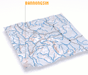 Places with similar names to Ban Nong Sim, Thailand ::
// Ban Nong Sema (TH)
// Ban Nong Sim (TH)
// Ban Nong Sim (TH)
// Ban Nong Sim (TH)
// Ban Nong Som (TH)
// Ban Nong Sum (TH)
// Ban Nongsim (LA)
Disclaimer :: Information on this page comes without warranty of any kind |
||
|
Where is Ban Nong Sim? Elevation and coordinates ::
Latitude (lat): 17°19'0"N Longitude (lon): 101°6'0"E
Elevation (approx.): 792m (map arrows pan, magnifying glasses zoom) |
||
|
Visiting Ban Nong Sim? Hotel/Accommodation ::
Book a hotel in Ban Nong Sim Travel Guide ::
Buy a travel guide for Thailand rental cars ::
car rental offers GPS waypoint ::
download a GPX waypoint (PoI) of Ban Nong Sim for your GPS receiver
|
||