|
search place name
|
||
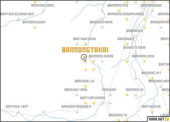
Ban Nong Ta Kai (Buriram, Thailand)Ban Nong Ta Kai is a town in the Buriram region of Thailand. An overview map of the region around Ban Nong Ta Kai is displayed below.
regional and 3d topo map of Ban Nong Ta Kai, Thailand ::
Ban Nong Ta Kai airports ::
The nearest airport is NAK - Nakhon Ratchasima Khorat, located 79.9 km north west of Ban Nong Ta Kai.
Other airports nearby include REP - Siem-reap Siem Reap (172.8 km south east), UTP - Rayong U Taphao Intl (272.5 km south west), Nearby towns ::
Ban Khok Yank (0.0km north) //
Ban Sa Si Liam (1.9km south) //
Ban Hin Khon Kong (1.8km east) //
Ban Nong Ta Si (2.6km south east) //
Ban Thung Pho (3.7km north) //
Ban Salao (3.7km north) //
Ban Thaen Banlang (3.6km east) //
Ban Khok Kruat (3.6km east) //
Ban Nong Muang (3.6km east) //
Ban Chum Saeng (4.1km north west) //
Ban Khok Makha (4.1km north west) //
Ban Nong Song Phi Nong (4.1km north west) //
Ban Nong Yang (4.1km north west) //
Ban Khok Loi (5.6km south) //
Ban Khok Yang (7.6km south) //
Ban Khok Yai (7.6km south) //
Ban Khok Kruat (7.6km south) //
Ban Nong Mama (8.2km north east) //
Prakham (9.2km south east) //
[all distances 'as the bird flies' and approximate]  Places with similar names to Ban Nong Ta Kai, Thailand ::
// Ban Ang Taek (TH)
// Ban Nong Dok (TH)
// Ban Nong Ta Kai (TH)
// Ban Nong Ta Kai (TH)
// Ban Nong Ta Kai (TH)
// Ban Nong Ta Kai (TH)
// Ban Nong Ta Kai (TH)
// Ban Nong Ta Kai (TH)
// Ban Nong Takai (TH)
// Ban Nong Takai (TH)
Disclaimer :: Information on this page comes without warranty of any kind |
||
|
Where is Ban Nong Ta Kai? Elevation and coordinates ::
Latitude (lat): 14°31'0"N Longitude (lon): 102°41'0"E
Elevation (approx.): 196m (map arrows pan, magnifying glasses zoom) |
||
|
Visiting Ban Nong Ta Kai? Hotel/Accommodation ::
Book a hotel in Ban Nong Ta Kai Travel Guide ::
Buy a travel guide for Thailand rental cars ::
car rental offers GPS waypoint ::
download a GPX waypoint (PoI) of Ban Nong Ta Kai for your GPS receiver
|
||