|
search place name
|
||
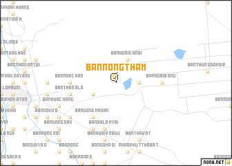
Ban Nong Tham (Sara Buri, Thailand)Ban Nong Tham is a town in the Sara Buri region of Thailand. An overview map of the region around Ban Nong Tham is displayed below.
regional and 3d topo map of Ban Nong Tham, Thailand ::
Ban Nong Tham airports ::
The nearest airport is BKK - Bangkok Intl, located 101.5 km south of Ban Nong Tham.
Other airports nearby include NAK - Nakhon Ratchasima Khorat (141.8 km east), PHS - Phitsanulok (223.8 km north), Nearby towns ::
Ban Nong Kham (1.9km north) //
Ban Nikhom Sang Ton Eng Lop Buri (3.6km east) //
Ban Huai Khrai (4.1km north east) //
Ban Tha Dua (4.0km south west) //
Ban Dong Madak (6.6km south west) //
Ban Huai Bong (7.2km east) //
Ban Nam Chan (7.2km west) //
Ban Tha Sala (7.4km west) //
Ban Sa Lamyai (7.6km south) //
Ban Na Yao (8.2km south west) //
Ban Nikhom Sang Ton Eng Saraburi (9.1km south west) //
[all distances 'as the bird flies' and approximate] 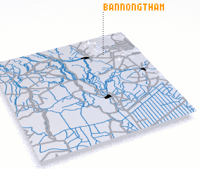 Places with similar names to Ban Nong Tham, Thailand ::
// Ban Nong Tham (TH)
// Ban Nong Tham (1) (TH)
// Ban Nong Thiam (TH)
// Ban Nong Thom (TH)
// Ban Nong Thom (TH)
// Ban Nong Thom (TH)
// Ban Nong Thom (TH)
// Ban Nong Thom (TH)
// Ban Nong Thom (TH)
// Ban Nong Thum (TH)
Disclaimer :: Information on this page comes without warranty of any kind |
||
|
Where is Ban Nong Tham? Elevation and coordinates ::
Latitude (lat): 14°49'0"N Longitude (lon): 100°46'0"E
Elevation (approx.): 62m (map arrows pan, magnifying glasses zoom) |
||
|
Visiting Ban Nong Tham? Hotel/Accommodation ::
Book a hotel in Ban Nong Tham Travel Guide ::
Buy a travel guide for Thailand rental cars ::
car rental offers GPS waypoint ::
download a GPX waypoint (PoI) of Ban Nong Tham for your GPS receiver
|
||