|
search place name
|
||
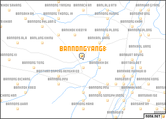
Ban Nong Yang (1) (Buriram, Thailand)Ban Nong Yang (1) is a town in the Buriram region of Thailand. An overview map of the region around Ban Nong Yang (1) is displayed below.
regional and 3d topo map of Ban Nong Yang (1), Thailand ::
Ban Nong Yang (1) airports ::
The nearest airport is NAK - Nakhon Ratchasima Khorat, located 74.1 km west of Ban Nong Yang (1).
Other airports nearby include REP - Siem-reap Siem Reap (184.0 km south east), Nearby towns ::
Ban Nong Lumphuk (1) (1.9km south) //
Ban Nong Yang Sai Yong (3.6km east) //
Ban Rai Khok (4.0km south east) //
Ban Kan Luang (5.2km north east) //
Ban Khok Kieo Ya (5.8km north) //
Ban Thanon Pradaeng Kaeo (6.5km south west) //
Ban Nong Haeng (7.4km south) //
Ban Tak Daet (7.7km south east) //
Ban Phaengphuai (7.7km south east) //
Ban Nong Plong (7.7km north east) //
Ban Khok Yang (7.7km north east) //
Ban Nong Lumphuk (7.7km south west) //
Ban Nong Pru (7.7km south west) //
Ban Kan Luang (7.7km south west) //
Ban Nong Kong (7.7km south west) //
Ban Chom Si (7.7km north west) //
Ban Nong Pru (8.2km south east) //
Ban Nong Ri (9.1km south east) //
[all distances 'as the bird flies' and approximate] 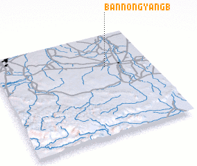 Places with similar names to Ban Nong Yang (1), Thailand :: Disclaimer :: Information on this page comes without warranty of any kind |
||
|
Where is Ban Nong Yang (1)? Elevation and coordinates ::
Latitude (lat): 14°41'0"N Longitude (lon): 102°43'0"E
Elevation (approx.): 180m (map arrows pan, magnifying glasses zoom) |
||
|
Visiting Ban Nong Yang (1)? Hotel/Accommodation ::
Book a hotel in Ban Nong Yang (1) Travel Guide ::
Buy a travel guide for Thailand rental cars ::
car rental offers GPS waypoint ::
download a GPX waypoint (PoI) of Ban Nong Yang (1) for your GPS receiver
|
||