|
search place name
|
||
Ban Nong Ya Plong (Kalasin, Thailand)Ban Nong Ya Plong is a town in the Kalasin region of Thailand. An overview map of the region around Ban Nong Ya Plong is displayed below.
regional and 3d topo map of Ban Nong Ya Plong, Thailand ::

Ban Nong Ya Plong airports ::
The nearest airport is SNO - Sakon Nakhon, located 69.5 km north east of Ban Nong Ya Plong.
Other airports nearby include ZVK - Savannakhet (106.6 km east), UTH - Udon Thani (131.1 km north west), VTE - Vientiane Wattay Intl (194.3 km north west), NAK - Nakhon Ratchasima Khorat (263.5 km south west), Nearby towns ::
Somdet (3.7km north) //
Ban Bon (4.0km north east) //
Ban Si Yaek (4.1km north west) //
Ban Hua Wua (5.1km south east) //
Ban Khok Klang (5.6km north) //
Ban Nong Pa Oi (6.6km north east) //
Ban Yang Talat (6.6km south east) //
Ban Kham Phai (7.1km west) //
Ban Yot Kaeng (8.2km south west) //
Ban Nong I But (9.0km south east) //
Ban Song Pluai (9.0km south east) //
Ban Nong Pha Om (9.0km south west) //
[all distances 'as the bird flies' and approximate] 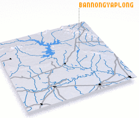 Places with similar names to Ban Nong Ya Plong, Thailand ::
// Ban Nong Ya Plong (TH)
// Ban Nong Ya Plong (TH)
// Ban Nong Ya Plong (TH)
// Ban Nong Ya Plong (TH)
// Ban Nong Ya Plong (TH)
// Ban Nong Ya Plong (TH)
// Ban Nong Ya Plong (TH)
// Ban Nong Ya Plong (TH)
// Ban Nong Ya Plong (TH)
// Ban Nong Ya Plong (TH)
Disclaimer :: Information on this page comes without warranty of any kind |
||
|
Where is Ban Nong Ya Plong? Elevation and coordinates ::
Latitude (lat): 16°40'0"N Longitude (lon): 103°46'0"E
Elevation (approx.): 188m (map arrows pan, magnifying glasses zoom) |
||
|
Visiting Ban Nong Ya Plong? Hotel/Accommodation ::
Book a hotel in Ban Nong Ya Plong Travel Guide ::
Buy a travel guide for Thailand rental cars ::
car rental offers GPS waypoint ::
download a GPX waypoint (PoI) of Ban Nong Ya Plong for your GPS receiver
|
||