|
search place name
|
||
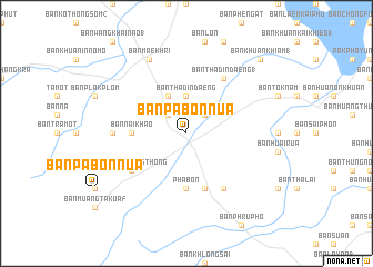
Ban Pa Bon Nua (Phatthalung, Thailand)Ban Pa Bon Nua is a town in the Phatthalung region of Thailand. An overview map of the region around Ban Pa Bon Nua is displayed below.
regional and 3d topo map of Ban Pa Bon Nua, Thailand ::
Ban Pa Bon Nua airports ::
The nearest airport is HDY - Songkhla Hat Yai Intl, located 46.1 km south east of Ban Pa Bon Nua.
Other airports nearby include TST - Trang (65.6 km west), LGK - Pulau Langkawi Intl (116.0 km south west), PAN - Pattani (122.2 km south east), AOR - Alor Setar Sultan Abdul Halim (123.6 km south), Nearby towns ::
Ban Pa Bon Tam (3) (2.6km north east) //
Ban Hoi Khong (2.6km north west) //
Ban Khuan Khiam (3.7km north) //
Ban Tha Din Daeng (3.7km north) //
Ban Phi Pan Rup (4.1km north west) //
Ban Nai Khao (5.5km west) //
Pha Bon (5.6km south) //
Ban Pa Bon Tam (5.6km south) //
Ban Pa Bak (5.9km south) //
Ban Phlu Nong Thong (6.6km south west) //
Ban Tha Din Daeng (1) (6.7km north east) //
Ban Khok Pho (1) (6.7km south east) //
Ban Khlong Yai (7.4km west) //
Ban Mae Khri (8.3km north west) //
Ban Khuan Khiam (1) (10.4km north east) //
[all distances 'as the bird flies' and approximate] 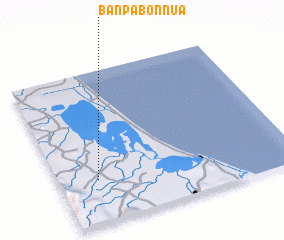 Places with similar names to Ban Pa Bon Nua, Thailand ::
Disclaimer :: Information on this page comes without warranty of any kind |
||
|
Where is Ban Pa Bon Nua? Elevation and coordinates ::
Latitude (lat): 7°17'0"N Longitude (lon): 100°10'0"E
Elevation (approx.): 26m (map arrows pan, magnifying glasses zoom) |
||
|
Visiting Ban Pa Bon Nua? Hotel/Accommodation ::
Book a hotel in Ban Pa Bon Nua Travel Guide ::
Buy a travel guide for Thailand rental cars ::
car rental offers GPS waypoint ::
download a GPX waypoint (PoI) of Ban Pa Bon Nua for your GPS receiver
|
||