|
search place name
|
||
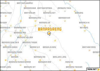
Ban Pa Daeng (Chon Buri, Thailand)Ban Pa Daeng is a town in the Chon Buri region of Thailand. An overview map of the region around Ban Pa Daeng is displayed below.
regional and 3d topo map of Ban Pa Daeng, Thailand ::
Ban Pa Daeng airports ::
The nearest airport is UTP - Rayong U Taphao Intl, located 71.6 km south west of Ban Pa Daeng.
Other airports nearby include BKK - Bangkok Intl (106.2 km north west), HHQ - Prachuap Khiri Khan Hua Hin (163.0 km south west), NAK - Nakhon Ratchasima Khorat (203.7 km north east), Nearby towns ::
Ban Nong Pradu (2.6km south east) //
Ban Bo Kwang Thong (3.7km north) //
Ban Nong Sa (4.1km north west) //
Ban U Pla Kang (5.6km south) //
Ban Noen Mok (6.6km north west) //
Ban Nong Ket (7.4km north) //
Ban Noen Hin (7.8km north east) //
Ban Nong Pru (7.8km north west) //
Ban Pa Yup (7.8km south west) //
Ban Nong Phai Kaeo (8.1km south west) //
Ban Nong Ta Son (8.1km south west) //
Ban Tan Dam (10.3km north west) //
[all distances 'as the bird flies' and approximate] 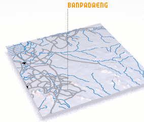 Places with similar names to Ban Pa Daeng, Thailand ::
// Ban Pa Daeng (TH)
// Ban Pa Daeng (TH)
// Ban Pa Daeng (TH)
// Ban Pa Daeng (TH)
// Ban Pa Daeng (TH)
// Ban Pa Daeng (TH)
// Ban Pa Daeng (TH)
// Ban Pa Daeng (TH)
// Ban Pa Daeng (TH)
// Ban Pa Daeng (TH)
Disclaimer :: Information on this page comes without warranty of any kind |
||
|
Where is Ban Pa Daeng? Elevation and coordinates ::
Latitude (lat): 13°15'0"N Longitude (lon): 101°19'0"E
Elevation (approx.): 66m (map arrows pan, magnifying glasses zoom) |
||
|
Visiting Ban Pa Daeng? Hotel/Accommodation ::
Book a hotel in Ban Pa Daeng Travel Guide ::
Buy a travel guide for Thailand rental cars ::
car rental offers GPS waypoint ::
download a GPX waypoint (PoI) of Ban Pa Daeng for your GPS receiver
|
||