|
search place name
|
||
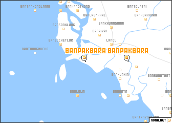
Ban Pak Ba Ra (Satun, Thailand)Ban Pak Ba Ra is a town in the Satun region of Thailand. An overview map of the region around Ban Pak Ba Ra is displayed below.
regional and 3d topo map of Ban Pak Ba Ra, Thailand ::
Ban Pak Ba Ra airports ::
The nearest airport is LGK - Pulau Langkawi Intl, located 57.5 km south of Ban Pak Ba Ra.
Other airports nearby include HDY - Songkhla Hat Yai Intl (73.5 km east), TST - Trang (74.0 km north), AOR - Alor Setar Sultan Abdul Halim (103.6 km south east), PAN - Pattani (157.2 km east), Nearby towns ::
Ban Laem Khae (2.6km north west) //
Ban Kota (2.6km north west) //
Amphoe Langu (2.6km north west) //
Ban Pi Yai (6.5km north east) //
Langu (6.6km north east) //
Ban Bo Chet Luk (6.6km north west) //
Ban Lo Lai (7.6km south) //
Ban Hua Hin (7.6km south) //
Ban Ta Laem (7.6km east) //
Ban To La Tai (7.6km east) //
Ban To La Nua (7.6km east) //
Ban Hua Hin (7.6km east) //
Ban Hua Hin (8.2km south east) //
Ban Kota (8.2km north east) //
Ban Son Klang (8.5km north west) //
Ban Khuan Sanai (9.2km north east) //
Ban Na Ya (10.4km south east) //
[all distances 'as the bird flies' and approximate]  Places with similar names to Ban Pak Ba Ra, Thailand ::
// Ban Pak Bara (TH)
Disclaimer :: Information on this page comes without warranty of any kind |
||
|
Where is Ban Pak Ba Ra? Elevation and coordinates ::
Latitude (lat): 6°51'0"N Longitude (lon): 99°44'0"E
Elevation (approx.): -32768m (map arrows pan, magnifying glasses zoom) |
||
|
Visiting Ban Pak Ba Ra? Hotel/Accommodation ::
Book a hotel in Ban Pak Ba Ra Travel Guide ::
Buy a travel guide for Thailand rental cars ::
car rental offers GPS waypoint ::
download a GPX waypoint (PoI) of Ban Pak Ba Ra for your GPS receiver
|
||