|
search place name
|
||
Ban Pak Chong Noi (Nakhon Ratchasima, Thailand)Ban Pak Chong Noi is a town in the Nakhon Ratchasima region of Thailand. An overview map of the region around Ban Pak Chong Noi is displayed below.
regional and 3d topo map of Ban Pak Chong Noi, Thailand ::

Ban Pak Chong Noi airports ::
The nearest airport is NAK - Nakhon Ratchasima Khorat, located 78.2 km east of Ban Pak Chong Noi.
Other airports nearby include BKK - Bangkok Intl (120.8 km south west), Nearby towns ::
Ban Pang Kae (1.1km south) //
Pak Chong (2.7km north east) //
Ban Wa Kachieo (3.6km south) //
Ban Sathani Bandai Ma (3.6km west) //
Ban Sao Thong (3.9km north east) //
Ban Nong Ka Cha (4.0km north) //
Ban Nong Sarai (1) (4.0km north east) //
Ban Chong Khae (5.3km north east) //
Ban Rai (5.8km south) //
Ban Thung Sawang (7.6km north east) //
Ban Tha Manao (7.7km north east) //
Ban Khanong Phra Tai (9.2km south east) //
Ban Khanong Phra Klang (1) (9.2km south east) //
Ban Khanong Phra Nua (11.2km south east) //
Ban Nong Takhain (12.0km north west) //
[all distances 'as the bird flies' and approximate] 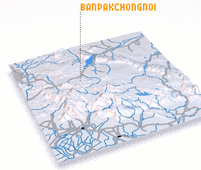 Places with similar names to Ban Pak Chong Noi, Thailand :: Disclaimer :: Information on this page comes without warranty of any kind |
||
|
Where is Ban Pak Chong Noi? Elevation and coordinates ::
Latitude (lat): 14°41'0"N Longitude (lon): 101°24'0"E
Elevation (approx.): 320m (map arrows pan, magnifying glasses zoom) |
||
|
Visiting Ban Pak Chong Noi? Hotel/Accommodation ::
Book a hotel in Ban Pak Chong Noi Travel Guide ::
Buy a travel guide for Thailand rental cars ::
car rental offers GPS waypoint ::
download a GPX waypoint (PoI) of Ban Pak Chong Noi for your GPS receiver
|
||