|
search place name
|
||
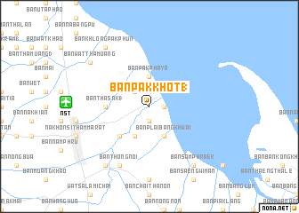
Ban Pak Khot (1) (Nakhon Si Thammarat, Thailand)Ban Pak Khot (1) is a town in the Nakhon Si Thammarat region of Thailand. An overview map of the region around Ban Pak Khot (1) is displayed below.
regional and 3d topo map of Ban Pak Khot (1), Thailand ::
Ban Pak Khot (1) airports ::
The nearest airport is NST - Nakhon Si Thammarat Cha Ian, located 10.4 km west of Ban Pak Khot (1).
Other airports nearby include TST - Trang (116.2 km south west), HDY - Songkhla Hat Yai Intl (173.8 km south), HKT - Phuket Intl (194.9 km west), PAN - Pattani (222.3 km south east), Nearby towns ::
Ban Bang Chieo (1.9km south) //
Ban Pak Nakhon (1.8km east) //
Ban Don Thale (2.6km north west) //
Ban Pak Phaya (3.7km north) //
Ban Ko Mai Phai (4.1km south west) //
Ban Plai Bang Khwai (4.1km south east) //
Ban Bang Moi (5.2km south west) //
Ban Tha Sak (1) (5.5km west) //
Ban Bo Pho (5.5km west) //
Ban Thong Noi (8.3km south west) //
Ban Khlong Pak Phun (9.2km north west) //
Ban Hua Trut (9.2km south west) //
Ban Sam Phraek (9.2km south east) //
Ban Wat Tha Muang (9.2km north west) //
Ban Pak Phun (9.2km north west) //
[all distances 'as the bird flies' and approximate]  Places with similar names to Ban Pak Khot (1), Thailand :: Disclaimer :: Information on this page comes without warranty of any kind |
||
|
Where is Ban Pak Khot (1)? Elevation and coordinates ::
Latitude (lat): 8°28'0"N Longitude (lon): 100°3'0"E
Elevation (approx.): 5m (map arrows pan, magnifying glasses zoom) |
||
|
Visiting Ban Pak Khot (1)? Hotel/Accommodation ::
Book a hotel in Ban Pak Khot (1) Travel Guide ::
Buy a travel guide for Thailand rental cars ::
car rental offers GPS waypoint ::
download a GPX waypoint (PoI) of Ban Pak Khot (1) for your GPS receiver
|
||