|
search place name
|
||
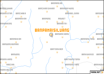
Ban Pa Mai Si Luang (Phayao, Thailand)Ban Pa Mai Si Luang is a town in the Phayao region of Thailand. An overview map of the region around Ban Pa Mai Si Luang is displayed below.
regional and 3d topo map of Ban Pa Mai Si Luang, Thailand ::
Ban Pa Mai Si Luang airports ::
The nearest airport is THL - Tachilek Tachileik, located 114.5 km north of Ban Pa Mai Si Luang.
Other airports nearby include LPT - Lampang (139.3 km south), MOG - Mong Hsat (139.5 km north west), PRH - Phrae (147.4 km south), KET - Kengtung (207.9 km north), Nearby towns ::
King Amphoe Pa Daet (2.5km south west) //
Ban San Khong (3.5km east) //
Ban Mai Tai (5.1km north east) //
Ban Pa Daet (5.8km north) //
Ban Ton Haen (5.8km south) //
Ban Pong (5.8km north) //
Pa Daet (6.6km north east) //
Ban Mae Loi Rai (10.2km north east) //
[all distances 'as the bird flies' and approximate]  Places with similar names to Ban Pa Mai Si Luang, Thailand :: Disclaimer :: Information on this page comes without warranty of any kind |
||
|
Where is Ban Pa Mai Si Luang? Elevation and coordinates ::
Latitude (lat): 19°27'0"N Longitude (lon): 99°58'0"E
Elevation (approx.): 379m (map arrows pan, magnifying glasses zoom) |
||
|
Visiting Ban Pa Mai Si Luang? Hotel/Accommodation ::
Book a hotel in Ban Pa Mai Si Luang Travel Guide ::
Buy a travel guide for Thailand rental cars ::
car rental offers GPS waypoint ::
download a GPX waypoint (PoI) of Ban Pa Mai Si Luang for your GPS receiver
|
||