|
search place name
|
||
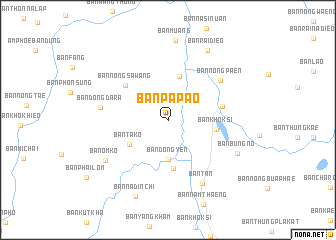
Ban Pa Pao (Udon Thani, Thailand)Ban Pa Pao is a town in the Udon Thani region of Thailand. An overview map of the region around Ban Pa Pao is displayed below.
regional and 3d topo map of Ban Pa Pao, Thailand ::
Ban Pa Pao airports ::
The nearest airport is UTH - Udon Thani, located 69.2 km south west of Ban Pa Pao.
Other airports nearby include SNO - Sakon Nakhon (91.7 km south east), VTE - Vientiane Wattay Intl (95.7 km north west), LOE - Loei (178.1 km west), ZVK - Savannakhet (188.6 km south east), Nearby towns ::
Ban Dong Yen (4.4km south) //
Ban Dong Saen Suk (5.0km north) //
Ban Ta Ko (5.0km south west) //
Ban Don Chiang Yun (5.4km south) //
Ban Khok Si (5.2km east) //
Ban Nong Sawang (6.0km north west) //
Ban Khok Don (6.0km east) //
Ban Nong Paen (7.1km north east) //
Ban Dong Dara (7.3km west) //
Ban Tan (7.9km south east) //
Ban Om Ko (8.0km south west) //
Ban Bung No (8.3km south east) //
Ban Muang (8.9km north) //
Ban Rai Dieo (8.8km north east) //
Ban Na Din Chi (9.2km south) //
[all distances 'as the bird flies' and approximate] 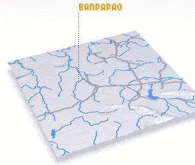 Places with similar names to Ban Pa Pao, Thailand ::
// Ban Na Pa Pae (TH)
// Ban Pap (TH)
// Ban Pa Pae (TH)
// Ban Pa Pae (TH)
// Ban Pa Pao (TH)
// Ban Pa Pao (TH)
// Ban Pa Pao (TH)
// Ban Pa Po (TH)
// Ban Pa Po (TH)
// Ban Pa Pu (TH)
Disclaimer :: Information on this page comes without warranty of any kind |
||
|
Where is Ban Pa Pao? Elevation and coordinates ::
Latitude (lat): 17°38'4"N Longitude (lon): 103°23'13"E
Elevation (approx.): 154m (map arrows pan, magnifying glasses zoom) |
||
|
Visiting Ban Pa Pao? Hotel/Accommodation ::
Book a hotel in Ban Pa Pao Travel Guide ::
Buy a travel guide for Thailand rental cars ::
car rental offers GPS waypoint ::
download a GPX waypoint (PoI) of Ban Pa Pao for your GPS receiver
|
||