|
search place name
|
||
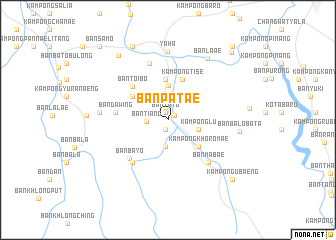
Ban Pa Tae (Yala, Thailand)Ban Pa Tae is a town in the Yala region of Thailand. An overview map of the region around Ban Pa Tae is displayed below.
regional and 3d topo map of Ban Pa Tae, Thailand ::
Ban Pa Tae airports ::
The nearest airport is PAN - Pattani, located 41.6 km north of Ban Pa Tae.
Other airports nearby include NAW - Narathiwat (68.3 km east), AOR - Alor Setar Sultan Abdul Halim (85.1 km west), HDY - Songkhla Hat Yai Intl (100.5 km north west), KBR - Kota Bahru Sultan Ismail Petra (130.9 km east), Nearby towns ::
Ban Bunae Sato (0.8km north) //
Ban Ta To (0.8km north) //
Ban Su Kae (0.9km north east) //
Kampong Hilong (1.1km south) //
Ban Tiang (2.3km west) //
Kampong Kela (2.7km north) //
Ban Ru Beng (2.9km south) //
Kampong Lu (3.6km east) //
Ban Ba Ro (3.9km north) //
Kampong Khoromae (4.5km south east) //
Ban Charo Timo (4.5km north) //
Kampong Tanalia (4.7km north west) //
Kampong Ka Long (4.7km north west) //
Kampong Tise (4.8km north) //
Ban To I Bo (5.4km north west) //
Ban Dawing (5.8km west) //
Ban Ba Ngo Pa O (5.8km west) //
Ban Ba Yo (6.1km south west) //
Kampong Bayo (6.2km south west) //
Ban Ma Bae (6.6km south east) //
Kampong Laengchaeng (6.7km north) //
Yaha (7.6km north) //
Amphoe Yaha (7.7km west) //
Ban Ba Lo Ba Ta (8.0km east) //
Ban La Ae (8.1km north east) //
Ban Ku Mi (9.0km north west) //
Kampong Kro (9.1km north west) //
Kampong Kra (9.1km north west) //
Kampong Ubaeng (9.7km south east) //
[all distances 'as the bird flies' and approximate]  Places with similar names to Ban Pa Tae, Thailand ::
// Ban I Pat (TH)
// Ban I Pat (TH)
// Ban Na Pa To (TH)
// Ban Na Po Tai (TH)
// Ban Na Po Tai (TH)
// Ban Pa (3) (TH)
// Ban Pa Da (TH)
// Ban Padao (TH)
// Ban Pa Du (TH)
// Ban Pa Du (TH)
Disclaimer :: Information on this page comes without warranty of any kind |
||
|
Where is Ban Pa Tae? Elevation and coordinates ::
Latitude (lat): 6°24'34"N Longitude (lon): 101°8'8"E
Elevation (approx.): 52m (map arrows pan, magnifying glasses zoom) |
||
|
Visiting Ban Pa Tae? Hotel/Accommodation ::
Book a hotel in Ban Pa Tae Travel Guide ::
Buy a travel guide for Thailand rental cars ::
car rental offers GPS waypoint ::
download a GPX waypoint (PoI) of Ban Pa Tae for your GPS receiver
|
||